Giochi dell'Oca e di percorso
(by Luigi Ciompi & Adrian Seville)
(by Luigi Ciompi & Adrian Seville)
|
Giochi dell'Oca e di percorso
(by Luigi Ciompi & Adrian Seville) |
|
|
 |
Torna alla ricerca giochi (back to game search) |
 |
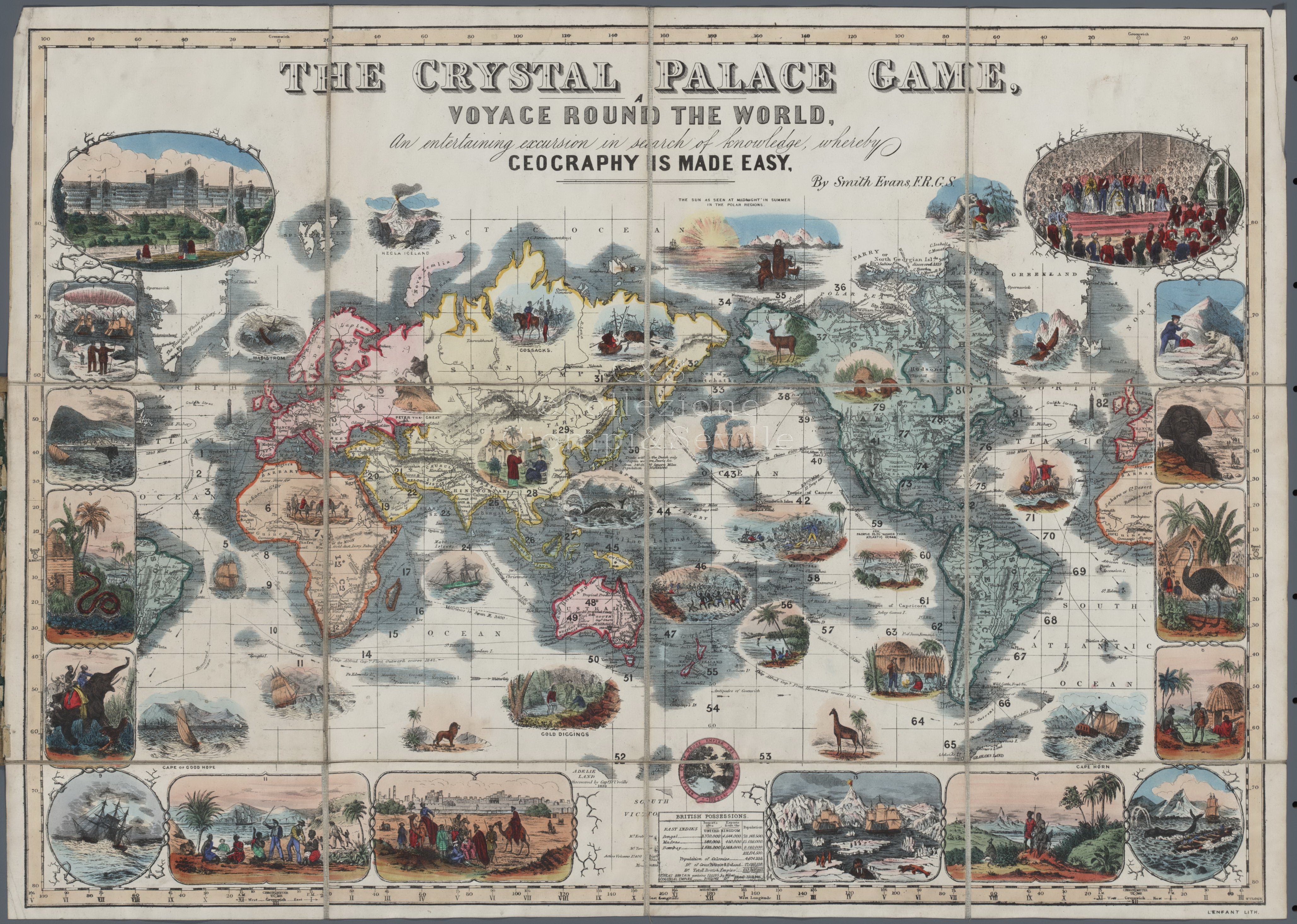
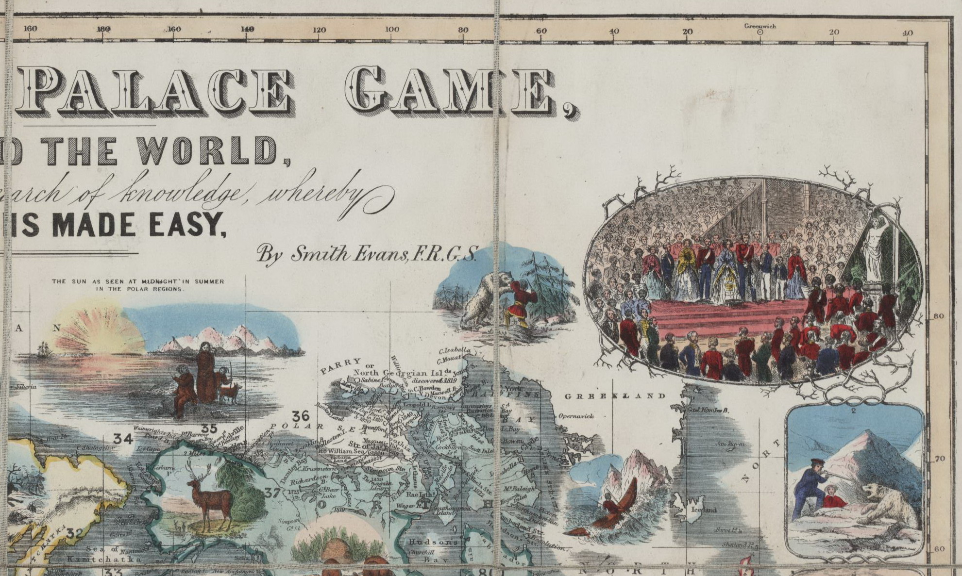
| Crystal (The) Palace Game. Voyage Round the World | ||
| An entertaining excursion in search of knowledge, whereby geography is made Easy. | ||
 |
Versione stampabile
 |
Invia una segnalazione

|
                    |
primo autore: | Non indicato |
| secondo autore: | Smith Evans | |
| anno: | 1855ca | |
| luogo: |
Inghilterra-Londra |
|
| periodo: | XIX secolo (3°/4) | |
| percorso: | Percorso di 82 caselle numerate | |
| materiale: | carta (paper) (papier) | |
| dimensioni: | 455X647 | |
| stampa: | Litografia colorata a mano (hand-coloured engraving) | |
| luogo acquisto: | ||
| data acquisto: | ||
| dimensioni confezione: | 203X172 | |
| numero caselle: | 82 | |
| categoria: | Geografia | |
| tipo di gioco: | Gioco di percorso | |
| editore: | Smith Evans | |
| stampatore: | F.R.G.S. LENFANT Lith. Alfred Davis&Co. 58, 59 & 60 Houndsditch, London. | |
| proprietario: | Collezione Privata | |
| autore delle foto: | L. Ciompi | |
| numero di catalogo: | 126 | |
| descrizione: |
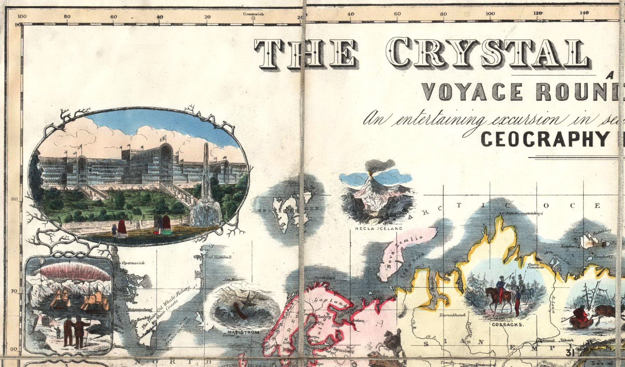
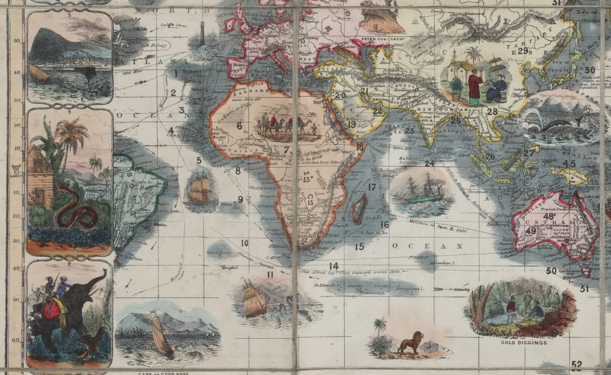
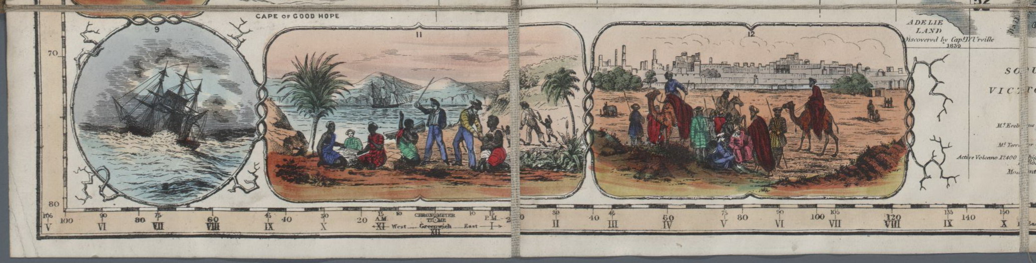
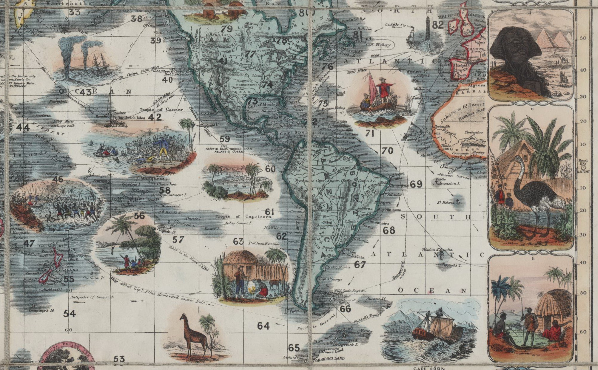
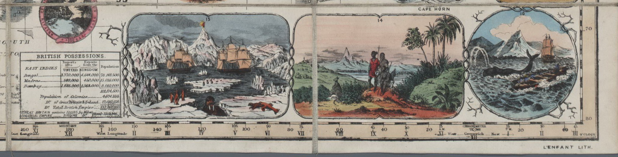
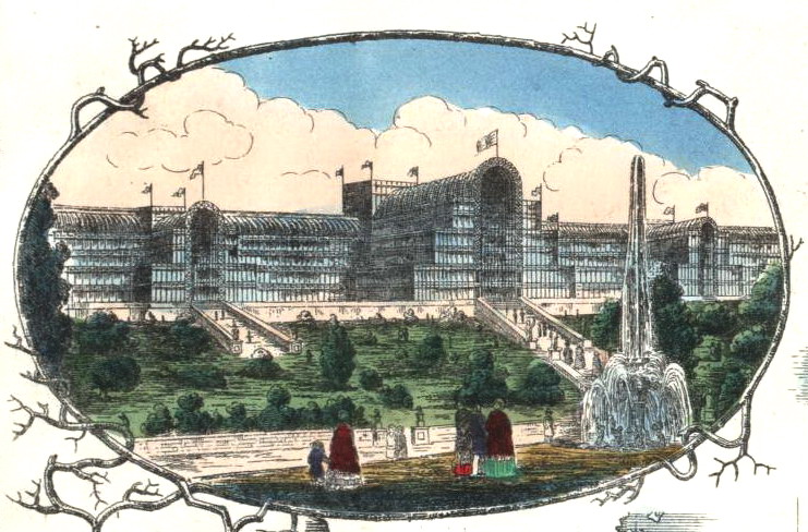
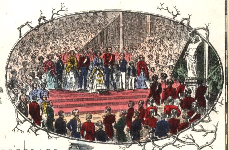
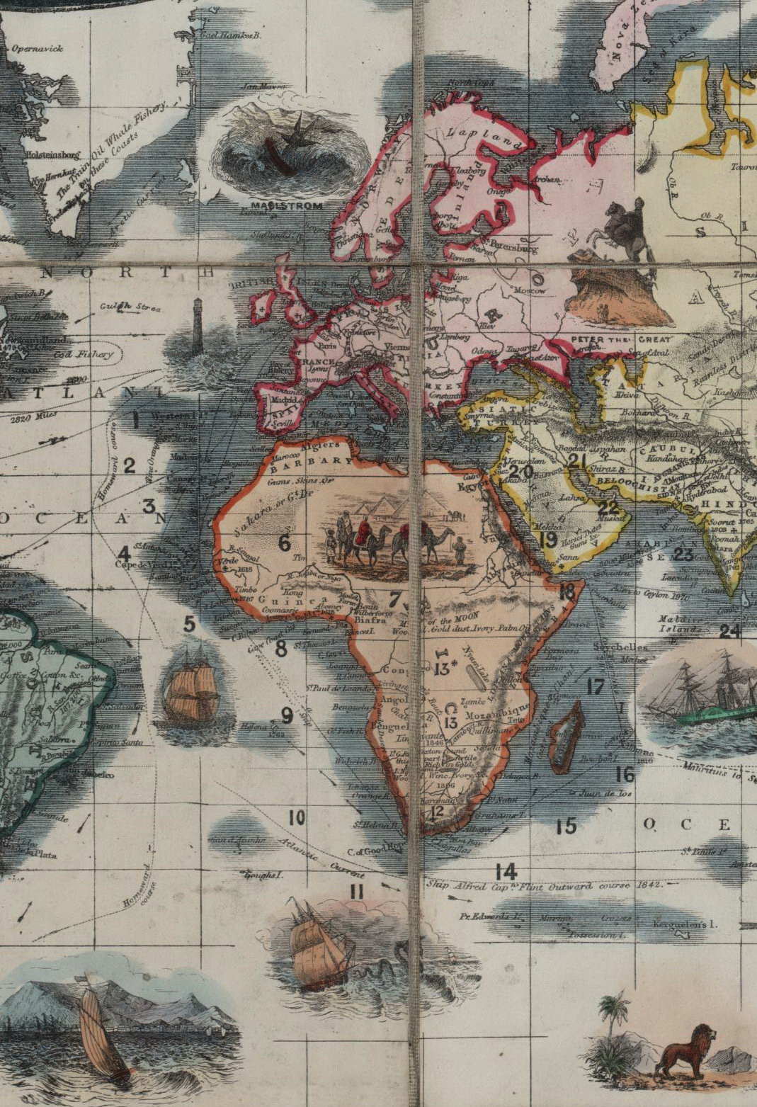
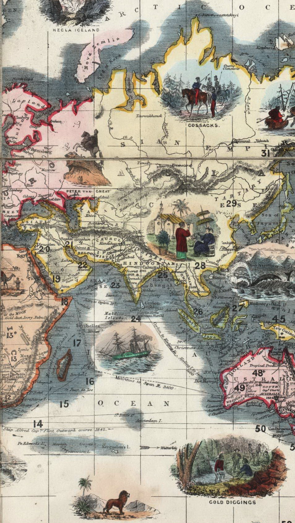
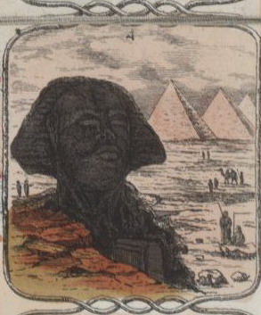
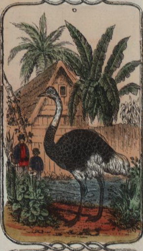
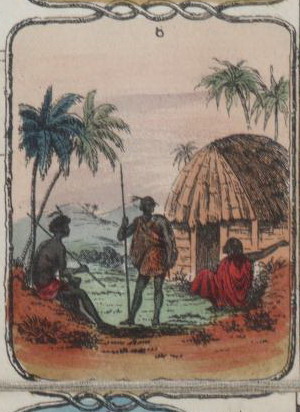
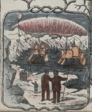
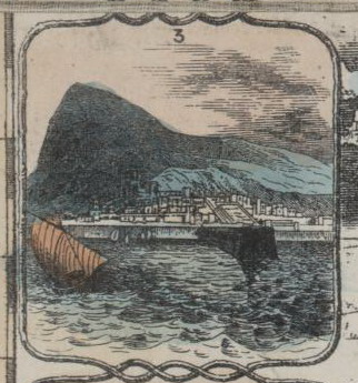
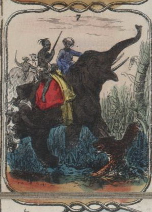
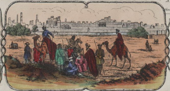
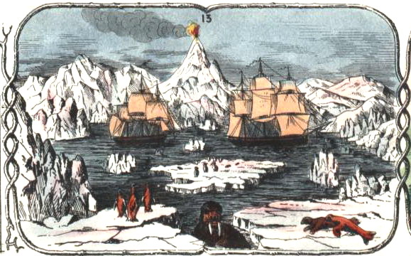
Gioco di percorso con 82 caselle distribuite su carta geografica. REGOLE: non riportate sul tavoliere. CASELLE: mute. REFERENZA 1 WHITEHOUSE, Francis Reginald Beaman, (pag. 20): THE CRYSTAL PALACE GAME - A VOYAGE ROUND THE WORLD. An entertaining excursion in search of knowledge, whereby geography is made Easy. By Smith Evans, F.R.G.S. LENFANT Lith. Alfred Davis&Co. 58, 59 & 60 Houndsditch, London. A lithograph which appears to have been transferred from an engraved plate from which maps have been printed and the lithograph adapted to a game size 27 ½ in X 19 in, partly hand-coloured, mounted in 12 sections on linen and folded into boards, cloth-coloured with title in gilt, size 7 in X 8 ½ in. The voyages of Captain Flint are plotted, populations stated and items of interest marked, e.g. the Pacific is 13.35 feet higher than the Atlantic Ocean. Tahiti to The Horn 55 days. The course of the GULPH stream is marked by arrows. In the oceans and around the map small pictures are inserted, e.g. a polar bear, the Sphinx, an ostrich and in an oval, Queen Victoria and Prince Albert standing on a dais in, presumably, the Crystal Palace. The game is undated, but it was probably published as a souvenir of the opening of the Crystal Palace in 1854. REFERENZA 2 Map of the world, presented as a board game. Illustrated around the edges with scenes depicting different activities around the world, including the Crystal Palace and the opening of the Great Exhibition 1851. Vignettes on map show lifestyles of people in different parts of the world. Relief shown by hachures. The Great Exhibition which opened in 1851 was conceived as a showcase for the culture and productions of Britain and her colonies. The Exhibition was held in Hyde Park in London in the specially constructed Crystal Palace. Designed by Sir Joseph Paxton in only 10 days, the Palace was a huge iron goliath with over a million feet of glass. The Exhibition itself spawned a variety of souvenirs. Smith Evans, a Fellow of the Royal Geographical Society, published maps of world shipping routes; it would have been an easy task for him to design an exciting game of world travel which highlighted the achievements of the Empire. The Crystal Palace game features an attractive border of vignettes of the countries to be visited, from the polar regions, to India and Africa. The map itself is also dotted with scenes including the discovery of gold in Australia, the death of Captain Cook, and the marooning of Alexander Selkirk on the Island of Juan Fernandez, a story which inspired the writing of Robinson Crusoe. At the top left hand corner of the game is a representation of the Crystal Palace itself and on the right a scene of the opening of the Great Exhibition by Queen Victoria and Prince Albert. Exhibitions: - "Instruction and Delight: Children's Games from the Ellen and Arthur Liman Collection" (Yale Center for British Art, 17 January-23 May, 2019). |
|
| bibliografia: |
1) GOODFELLOW, Caroline: "Jeux de société. Le guide du collectionneur des jeux de société depuis le XVIIIe siècle jusquà nos jours", (Edizione francese) Carrousel MS, 2001. 2) GOODFELLOW, Caroline: "A Collector's Guide to Games and Puzzles" Secaucus, New Jersey, Chartwell Books-London, Quintet Publishing Limited 1991. 3) GOODFELLOW, Caroline: "The Development of the English Board Game, 1770-1850", in Board Games Studies 1, 1998. 4) SEVILLE, Adrian: "The Game of Goose: and its influence on cartographical race games" Journal of the International Map Collectors' Society, Winter 2008 N°115 2008. 5) WHITEHAUSE, F.R.B.: "Table Games of Georgian and Victorian Days", London, Peter Garnett, 1951 6) SEVILLE, Adrian: "The geographical Jeux de l'Oie of Europe." In "Belgeo" 2008 3-4 2008. 7) LIMAN, Ellen: "Georgian and Victorian Board Games: The Liman Collection", Pointed Leaf Press, 2017 (pages 18, 24, 138). 8) NORCIA, Megan A.: "Gaming Empire in Children's British Board Games, 1836-1860". Studies in Childhood, 1700 to the Present. Routledge, 2019. 9) LudoSophia: "Jeux Anciens de Planisphère et de Mappemonde - Ancient Games with World Map, 2019. |
|
| "The Development of the English Board Game, 1770-1850" (Caroline G. Goodfellow) | ||
| Geographical Games. "Table Games of Georgian and Victorian Days". (Francis Reginald Beaman, Whitehause) | ||
Vai alla ricerca giochi Vai all'elenco autori