Giochi dell'Oca e di percorso
(by Luigi Ciompi & Adrian Seville)
(by Luigi Ciompi & Adrian Seville)
|
Giochi dell'Oca e di percorso
(by Luigi Ciompi & Adrian Seville) |
|
|
 |
Torna alla ricerca giochi (back to game search) |
 |
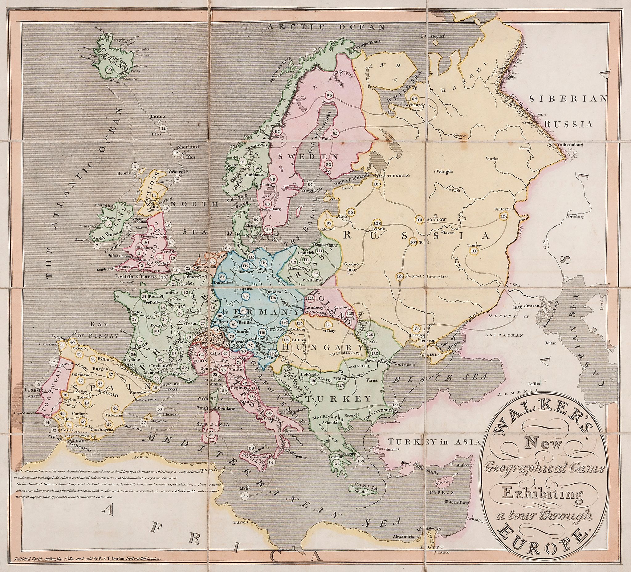
| Walker's New Geographical Game Exhibiting a Tour Through Europe | ||
 |
Versione stampabile
 |
Invia una segnalazione

|
                     |
primo autore: | Anonimo |
| secondo autore: | Darton William | |
| anno: | 1810 | |
| luogo: |
Inghilterra-Londra |
|
| periodo: | XIX secolo (1°/4) | |
| percorso: | Percorso di 133 caselle numerate | |
| materiale: | carta incollata su tela (engraving on paper with linen backing) | |
| dimensioni: | 455X502 | |
| stampa: | Litografia colorata a mano (hand-coloured engraving) | |
| luogo acquisto: | ||
| data acquisto: | ||
| dimensioni confezione: | ||
| numero caselle: | 133 | |
| categoria: | Geografia | |
| tipo di gioco: | Gioco di percorso | |
| editore: | Darton W.&T. | |
| stampatore: | Published for the Author May I.st 1810 and sols by W&T Darton, Holborn Hill, London. | |
| proprietario: | Collezione A. Seville | |
| autore delle foto: | A. Seville | |
| numero di catalogo: | 1368 | |
| descrizione: |
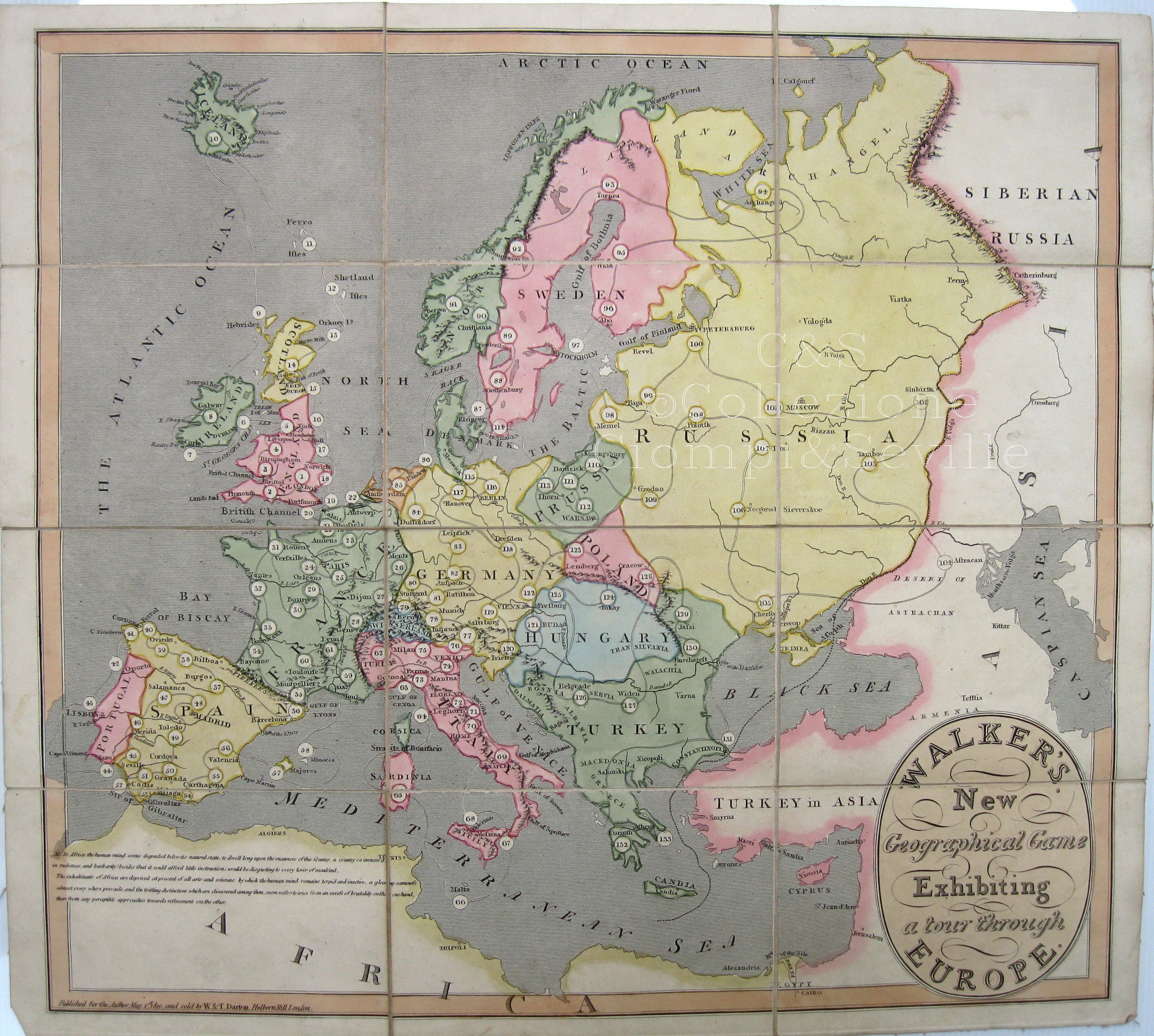
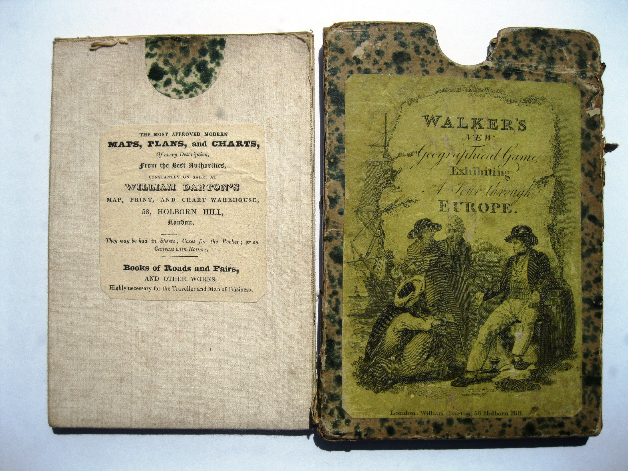
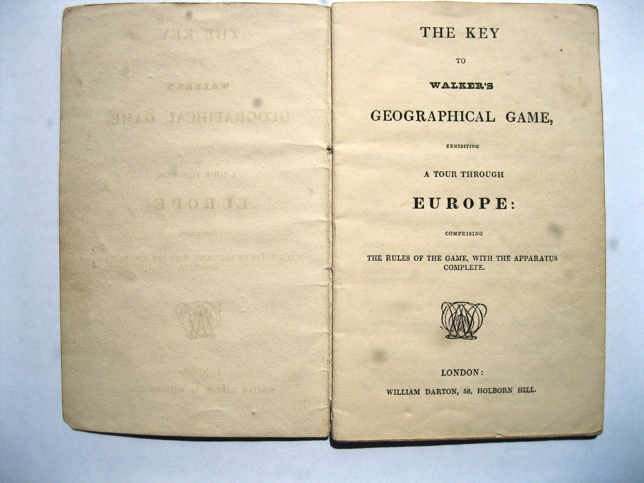
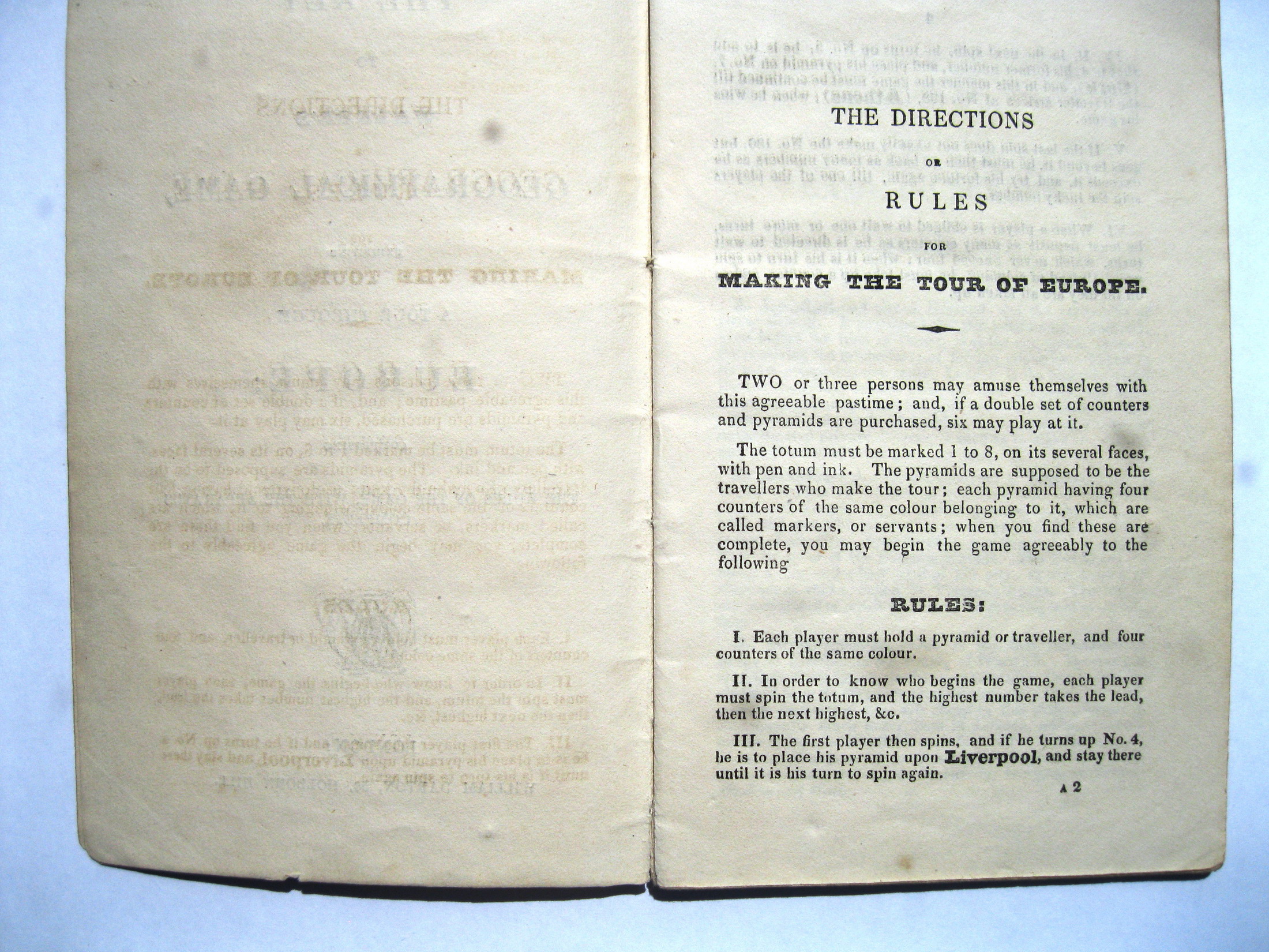
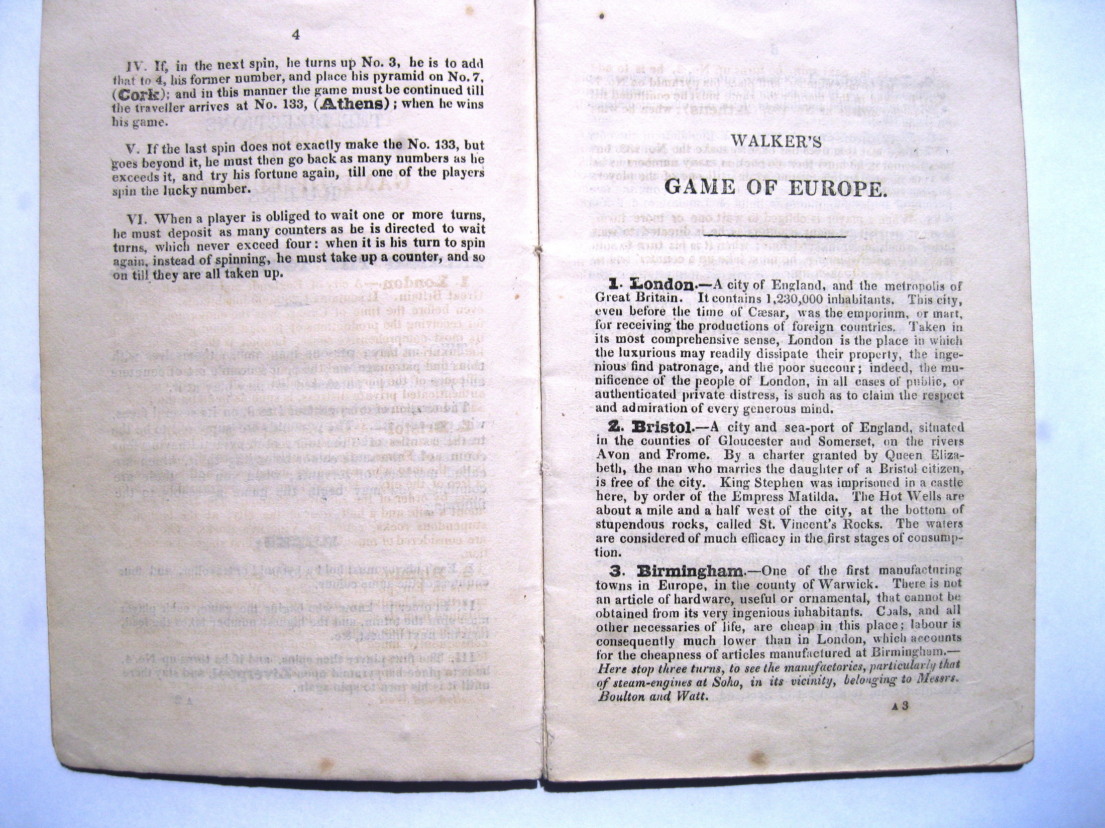
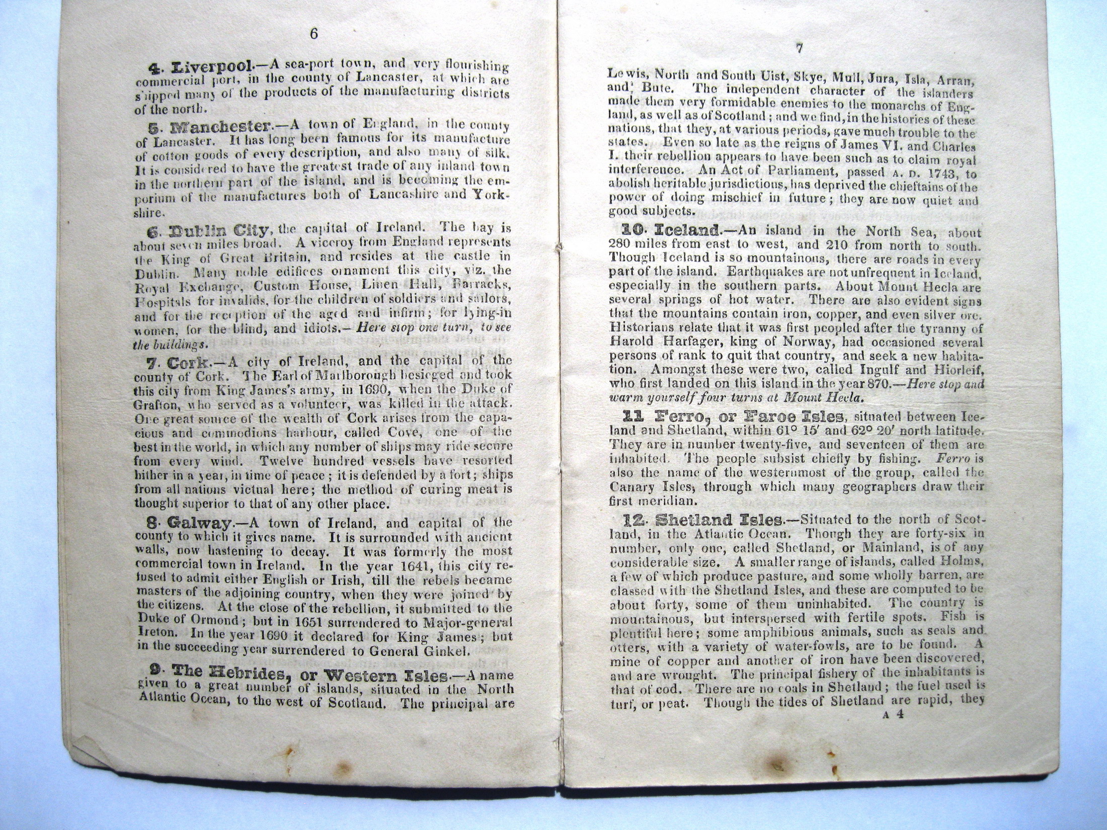
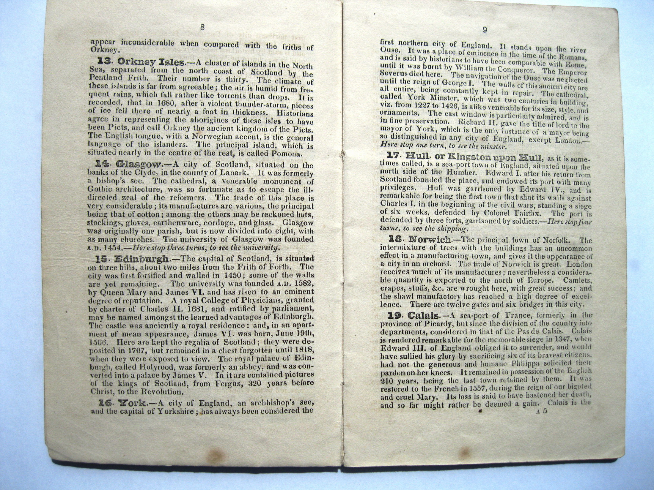
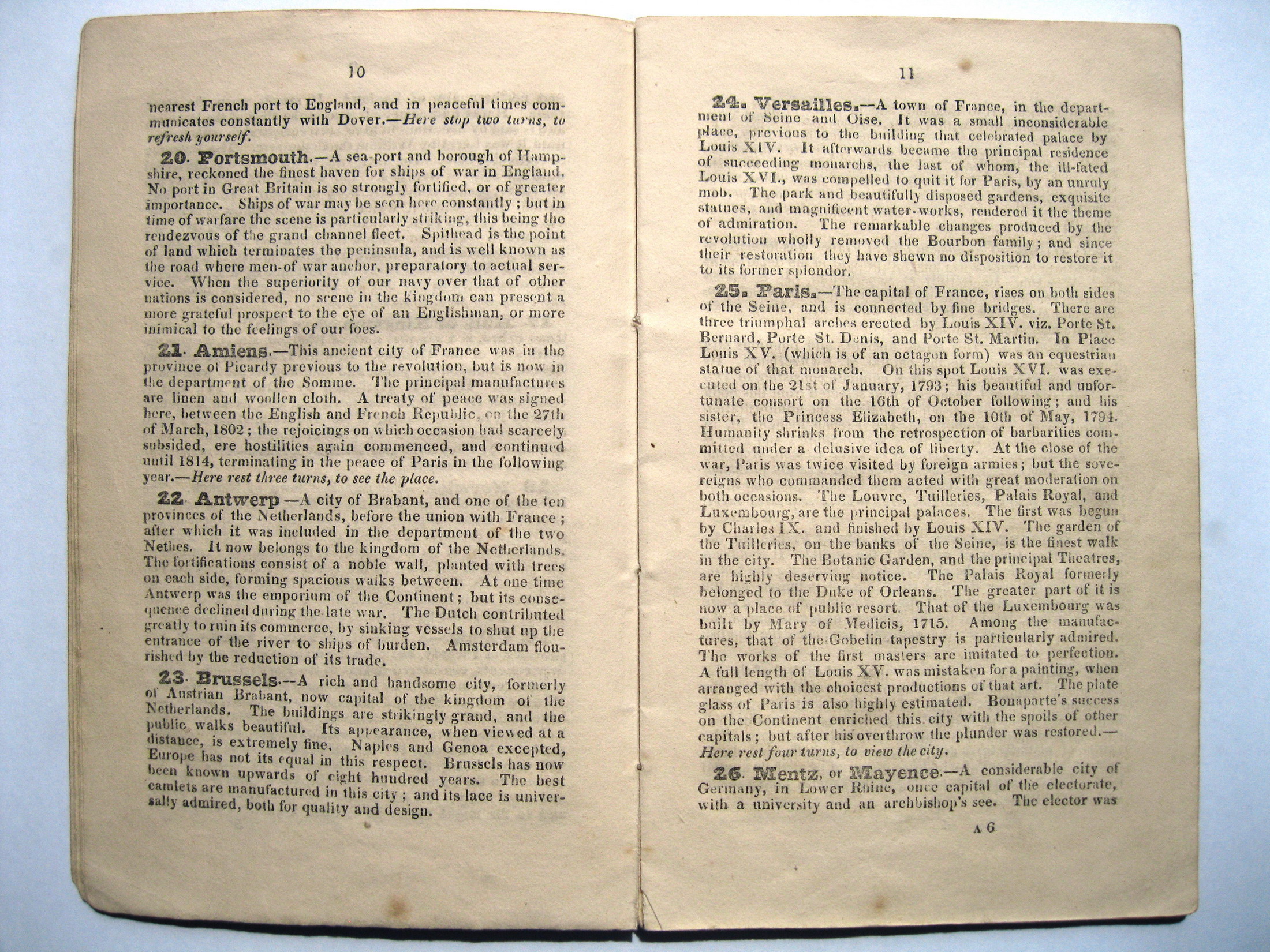
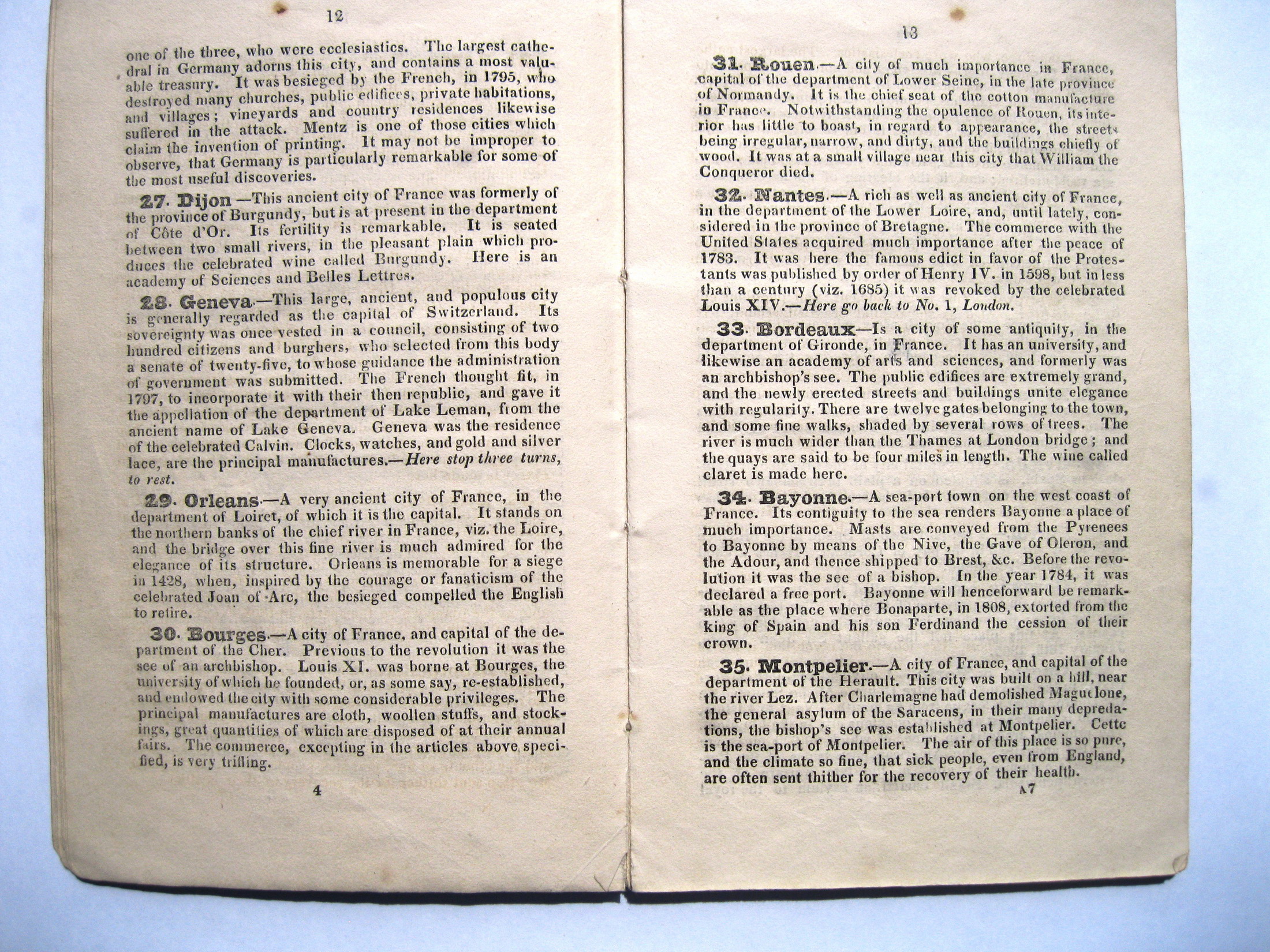
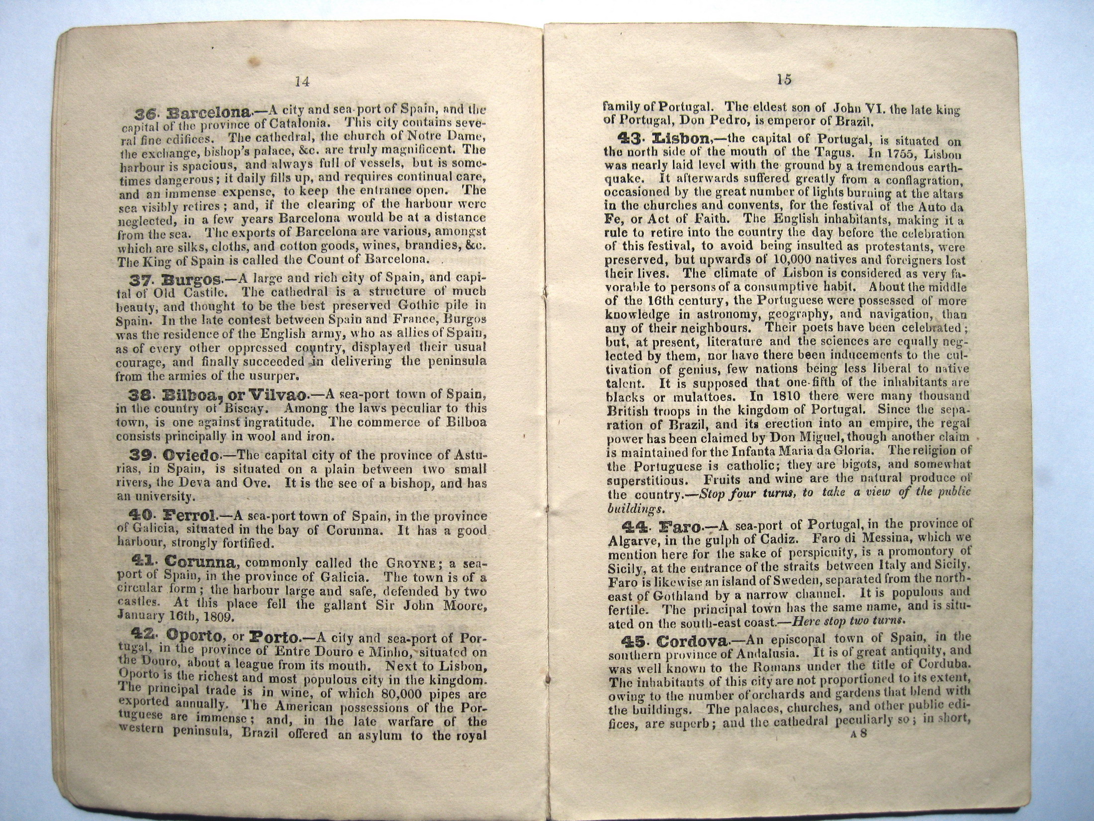
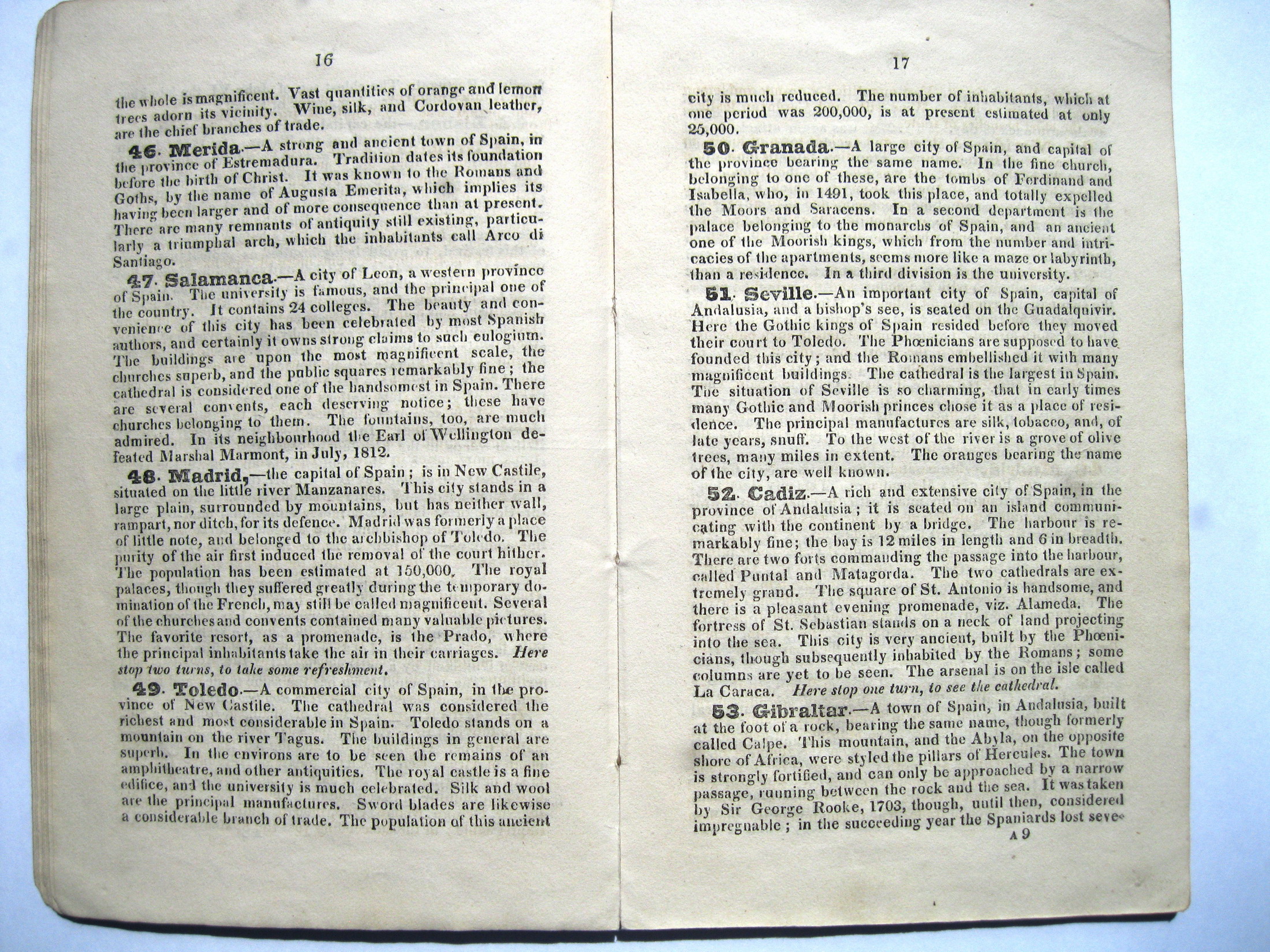
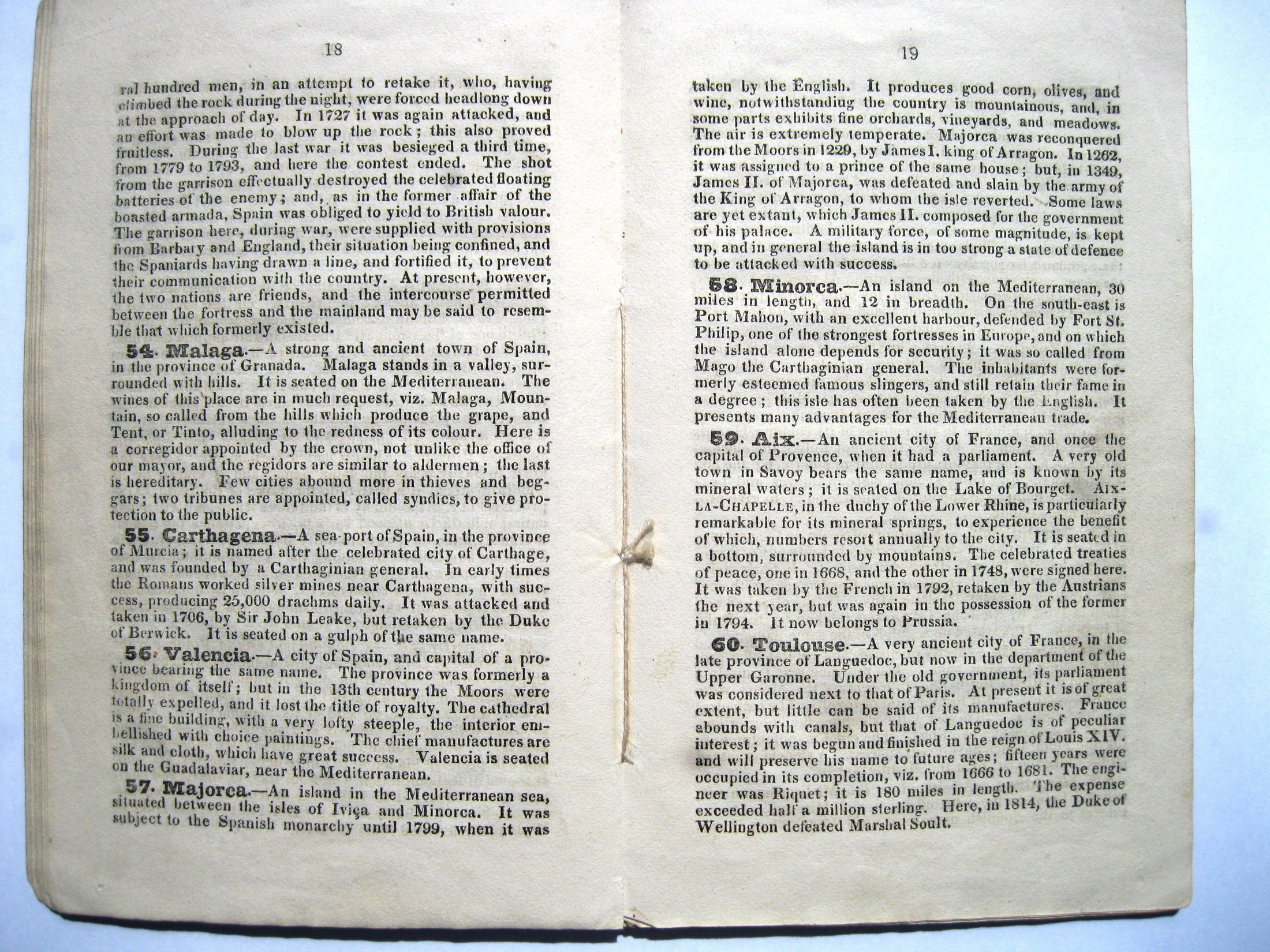
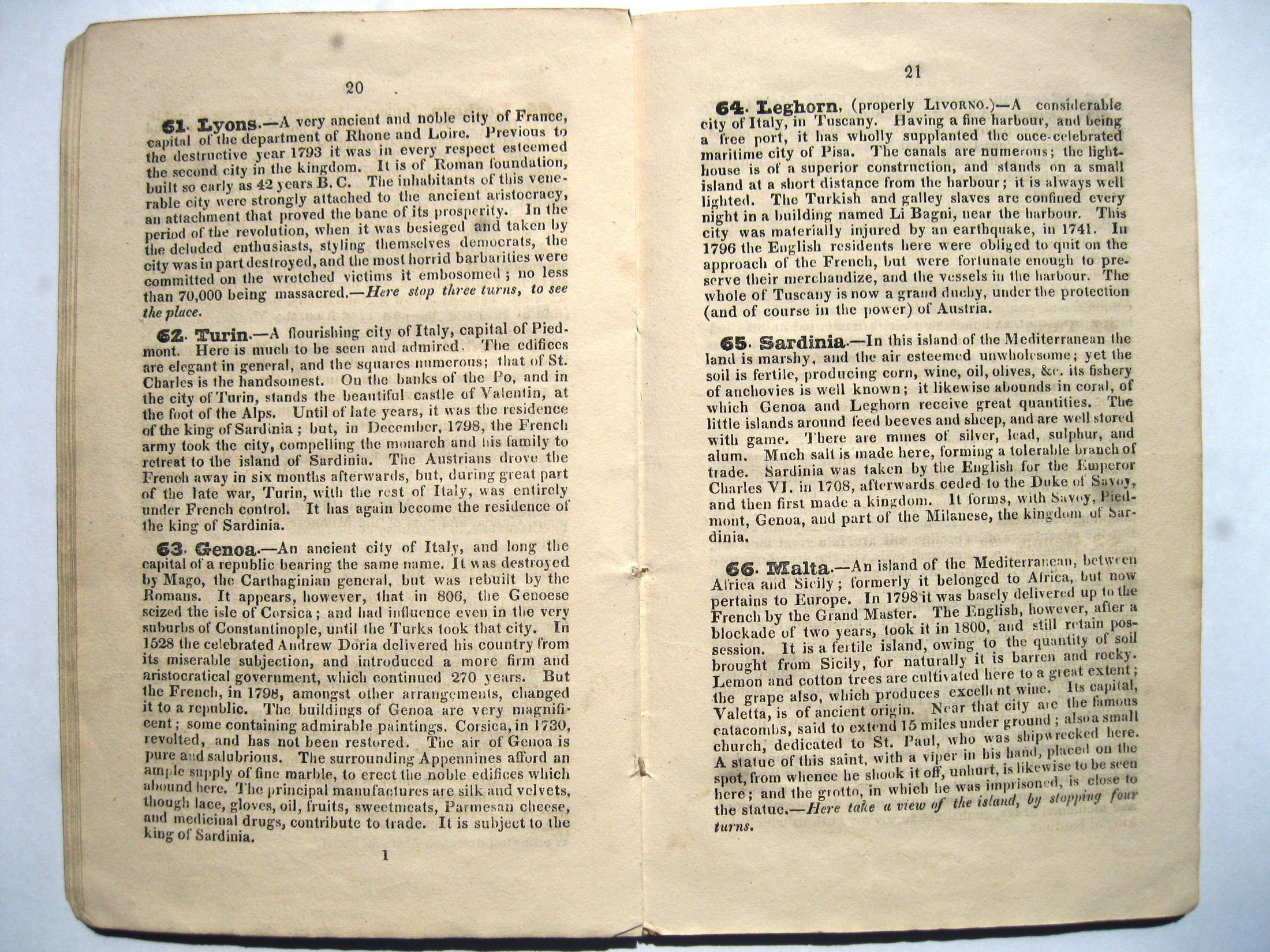
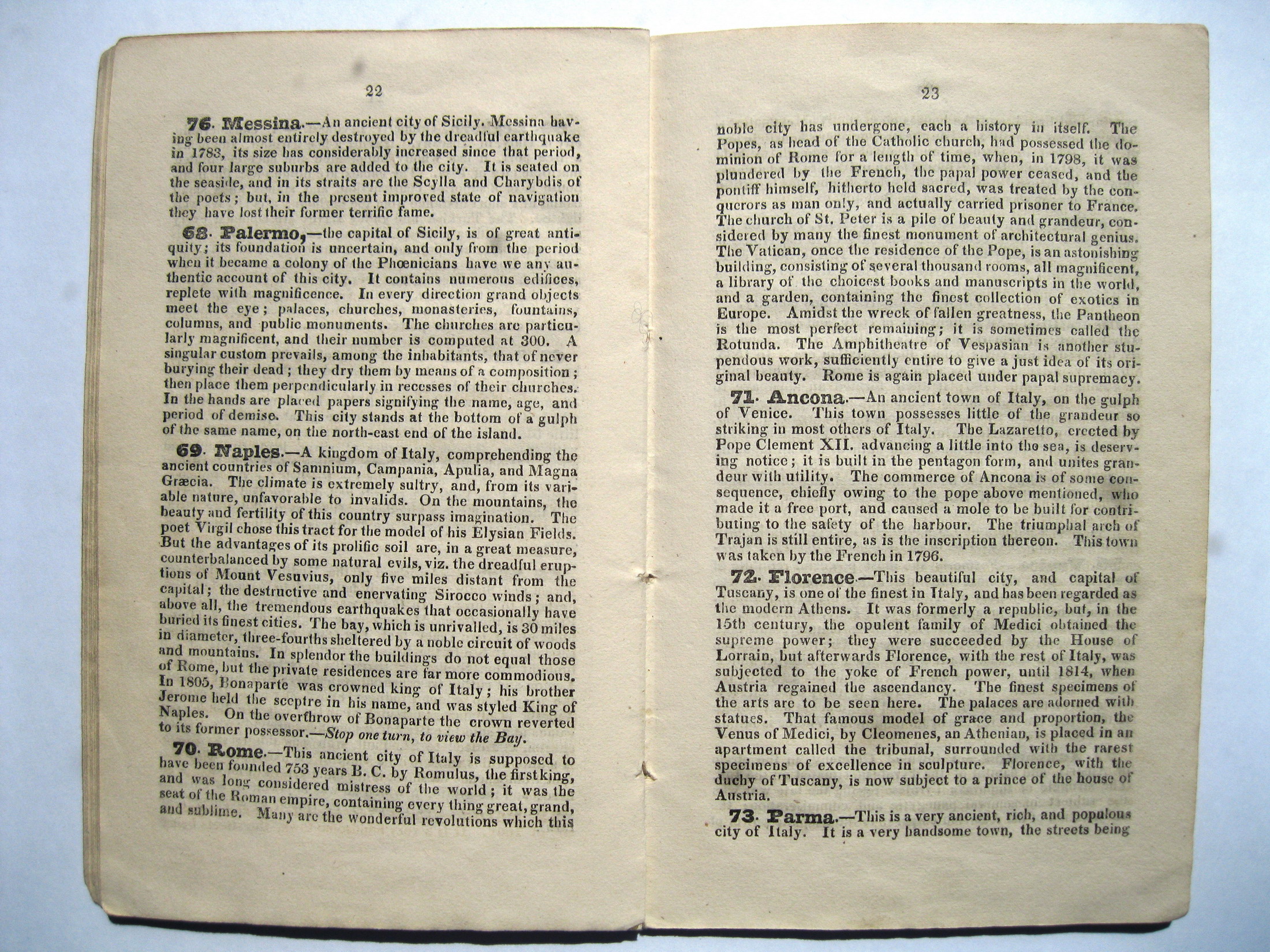
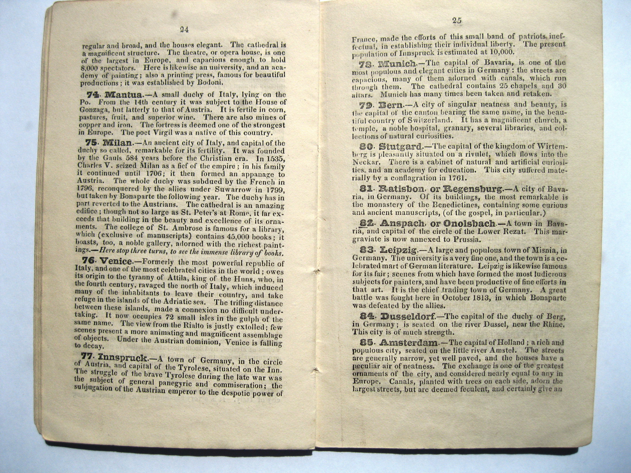
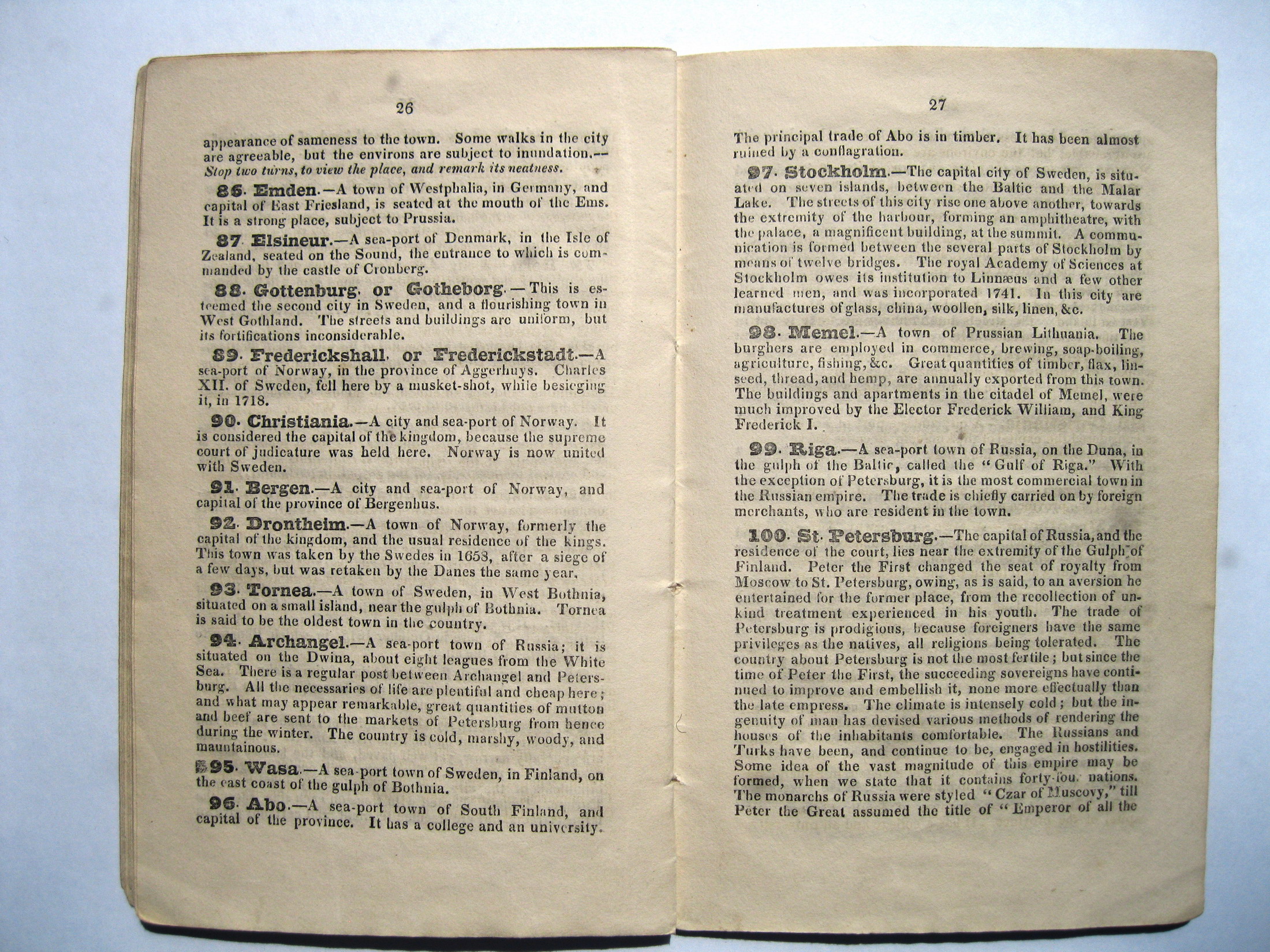
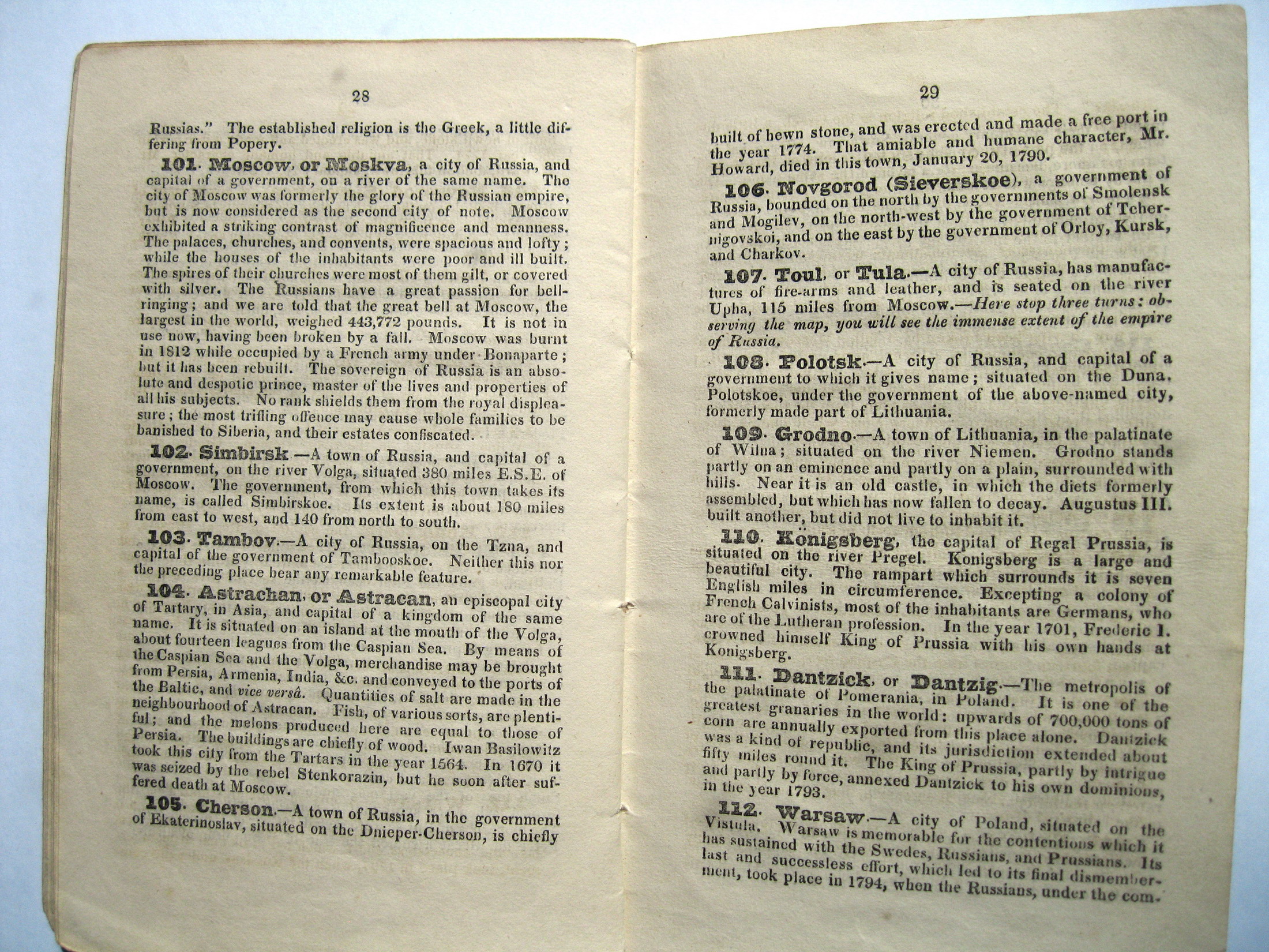
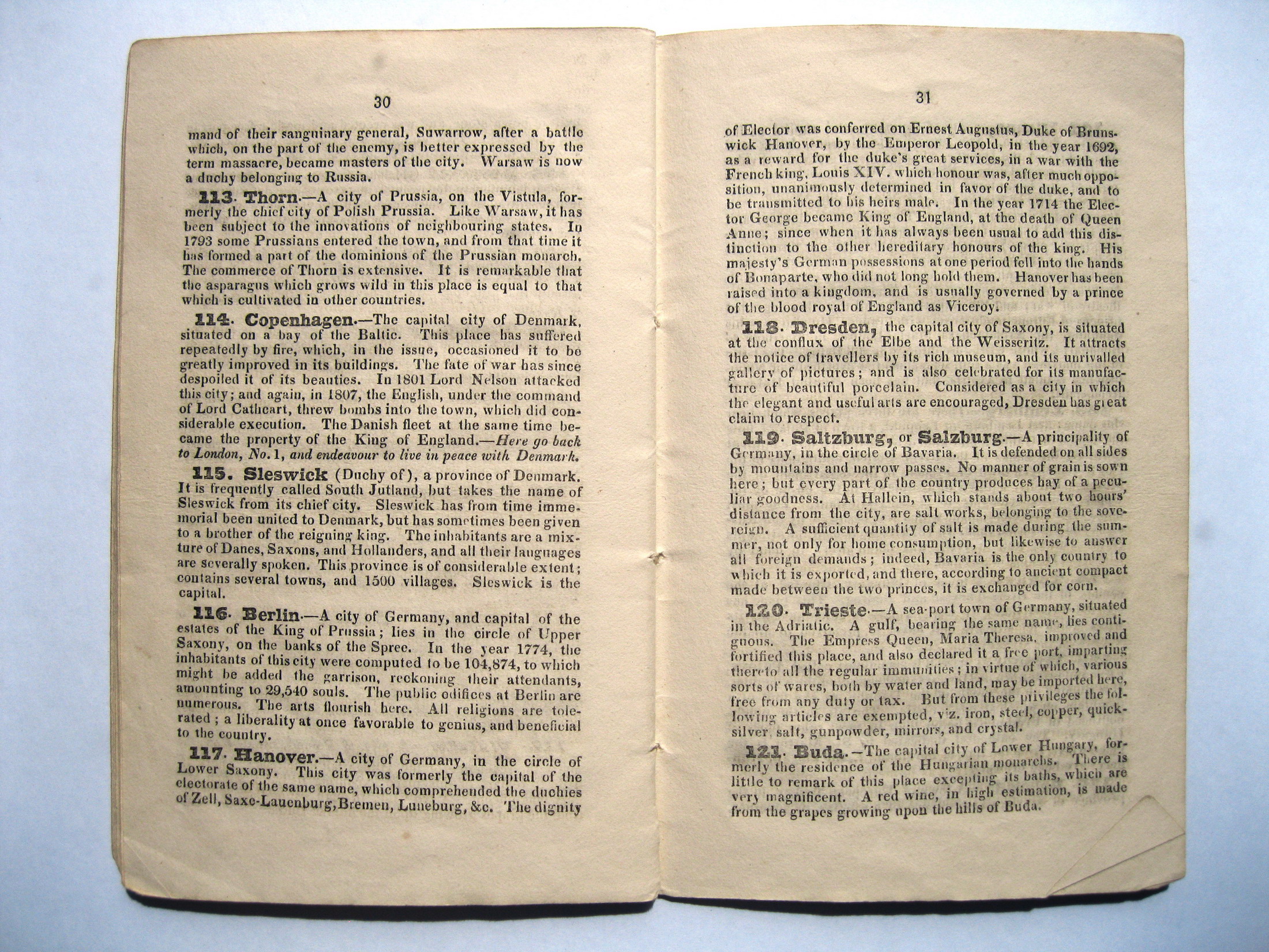
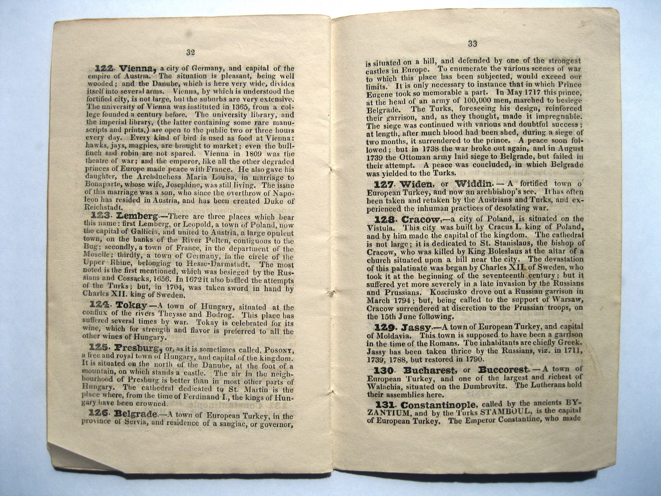
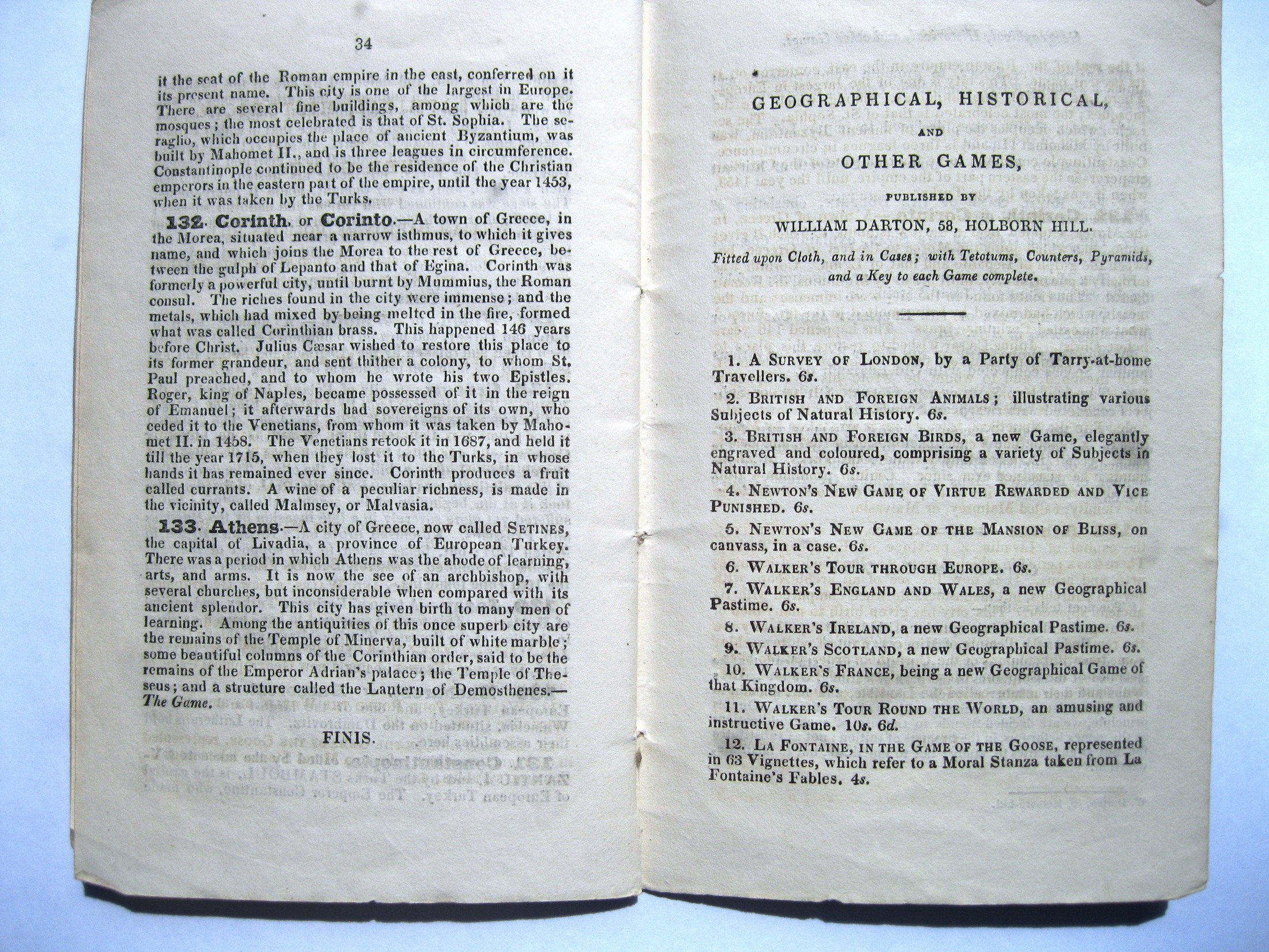
Gioco di 133 caselle numerate e distribuite sulla carta geografica dell'Europa. Si parte da Londra e si arriva ad Atene. Il "Nuovo Gioco Geografico di Walker con Tour dell'Europa", datato 1810, è in completo contrasto con i precedenti perché è ispirato al Gioco del Gran Tour di John Jefferys; il percorso si sviluppa su una grande mappa dell'Europa ed è contrassegnato da numeri cerchiati che rappresentano le città e i paesi visitati durante il gioco e ciascuno accuratamente descritto in un libretto di 34 pagine venduto insieme a quest'ultimo. Alcune caselle avevano indicazioni speciali ma la maggior parte era noiosa: a Parigi per esempio si doveva restare fermi quattro turni per visitare la città. Nantes (cas. 32) aveva ispirato negativamente il creatore del gioco, che l'aveva associata quasi alla casella della morte del gioco dell'oca: "E' stato qui che il famoso editto in favore dei Protestanti fu pubblicato nel 1598 ma in meno di un secolo fu revocato dal celebrato Luigi XIV. Qui si fa ritorno alla cas. 1, Londra". La Londra giorgiana era prettamente Protestante, quindi è evidente l'ironia della parola "celebrato". Il gioco fu pubblicato da W.&T. Darton e i Darton non avevano paura di promuovere le proprie idee attraverso i giochi destinati ai più giovani. REGOLE: non riportate sul tavoliere (allegate). CASELLE: mute. REFERENZA 1 "Walker's New Geographical Game Exhibiting a Tour Through Europe". (V&A Museum). In order to play this European centred race game each player must have a marker, usually in the shape of a pyramid, and four counters. An eight-sided teetotum spinner is also needed. There are 133 playing spaces covering the map playing surface, beginning in London and ending in Athens. A separate booklet sets out the rules and the rewards and forfeits for each numbered space. As well as providing information on the history and commerce of the places, the game also encouraged reading and conversational skills. Physical description Design: engraving coloured by hand, mounted on linen, showing map of Europe with the capitals and major cities numbered and also major sea routes N°of squares: 133 Squares illustrated: map of Europe Square numbering: all Squares titled: all in booklet Subject of starting square: London Subject of ending square: Athens Place of Origin: London Date: 01/05/1810 Artist/maker: Darton, William Materials and Techniques: Hand-coloured engraved paper on linen Dimensions: Length: 45.5 cm; width: 50.2 cm Object history note: dated on the label of the slip case Sept. 13th 1809. On the portion of the map marked Africa are comments on the lack of culture there see additional notes after the rules. Historical context note Rewards: forward movement, extra turns Forfeits: backward movement, missing turns N°of Players: 2 or 3 to 6 Equipment required: teetotum marked 1 to 8, markers or travellers for each player and 4 counters of a matching colour for each. Rules: DIRECTIONS FOR MAKING THE TOUR OF EUROPE. Two or three persons may amuse themselves with this agreeable pastime; and, if a double set of counters and pyramids are purchased, six may play at it. The totum must be marked 1 to 8, on its several faces, with pen and ink. The pyramids are supposed to be the travellers who the tour; each pyramid having 4 counters of the same colour belonging to it, which are called markers or servants; when you find these are complete, you may begin the game agreeably to the following. RULES: I. Each player must hold a pyramid or traveller and four counters of the same colour. II. In order to know who begins the game, each player must spin the totum, and the highest number takes the lead, then the next highest, &c. III. the first player then spins, and if he turns up No. 4, he is to place his pyramid upon Liverpool, and stay there until it is his turn to spin again. IV. If, in the next spin, he turns up No. 3, he is to add that to 4, his former number, and place his pyramid on No. 7 (Cork) and in this manner the game must be continued till the traveller arrives at No. 133 (Athens), when he wins his game. V. If the last spin does not exactly make the No. 133, but goes beyond it, he must then go back as many numbers as he exceeds it and try his fortune again, till one of the players spins the lucky number. VI. When a player is obliged to wait one or more turns, he must deposit as many counters as he is directed to waist turns (which never exceeds four) when it is his turn to spin again, instead of spinning he must take up a counter and so on till all have been taken up. The playing sheet is lettered in the lower left corner, over Morocco and Algeria with the following comment. It is one of the very few of its kind ever found in these games. NB In Africa the human mind seems degraded below its natural state, to dwell long upon the manners of this country, a country so immers'd in rudeness and barbarity, (besides that it could afford little instruction) would be disgusting to every lover of mankind. The inhabitants of Africa are deprived at present of all arts and sciences, by which the human mind remains torpid and inactive, a gloomy sameness every where revails, and the trifling distinctions which are discovered among them, seem rather to arise from an excess of brutality on the one hand, than any perceptible approaches towards refinement on the other. Rules placement: in booklet printed and sold by Wm. Darton Jun. 58 Holborn Hill (opposite Ely Place) 1810; Descriptive line: Hand coloured geographical game, Walker's Tour Through Europe, published by Darton in 1810 Attribution Note: Published for the author Walker REFERENZA 2 "Walker's New Geographical Game Exhibiting a Tour Through Europe" (Nouveau Jeu Géographique à travers toute l'Europe). On joue au Jeu de Walker de la meme manière qu'au Tour d'Europe de Wallis; il s'agit d'une gravure colorée à la main montée sur toile de lin, éditée par W.&T. Darton pour son auteur, Walker, à la date du 1.er mai 1810. Il présente les capitales, les villes et routes maritimes principales et la brochure indique les règles du jeu, les pénalités et récompenses relatives à chaque élément. Comme dans les autres jeux, l'accent est mis sur les éléments historiques et géographiques liés au commerce. Les champs lexicaux présents dans la brochure étaient destinés à des enfants de moins de 12 ans, ils apportaient du savoir tout autant qu'ils encourageaient la lecture." (GOODFELLOW Caroline) REFERENZA 3 "Walker's New Geographical Game Exhibiting a Tour Through Europe" is played in a similar manner to Wallis's Tour of Europe and was a hand-coloured engraving mounted on linen, published by W.&T. Darton for the author, Walker, on May 1st, 1810. It shows the capitals, major cities and major sea routes of Europe, and the accompanying rules booklet gives detailed descriptions and the rewards or forfeits for each. As with the other games, great emphasis is placed on the geographical and historical element together with commerce. The booklet used a wide vocabulary, and as the games were devised for children under the age of 12, they not only provided knowledge but also encouraged reading and speaking skills." (GOODFELLOW Caroline) |
|
| bibliografia: |
1) WHITEHAUSE, F.R.B.: "Table Games of Georgian and Victorian Days", London, Peter Garnett, 1951. 2) GOODFELLOW, Caroline: "A Collector's Guide to Games and Puzzles". Secaucus, New Jersey, Chartwell Books-London, Quintet Publishing Limited 1991. 3) GOODFELLOW, Caroline: "The Development of the English Board Game, 1770-1850", in Board Games Studies 1, 1998. 4) GOODFELLOW, Caroline: "Jeux de société. Le guide du collectionneur des jeux de société depuis le XVIIIe siècle jusquà nos jours", (Edizione francese) Carrousel MS, 2001. 5) SEVILLE, Adrian: "The Game of Goose: and its influence on cartographical race games" Journal of the International Map Collectors' Society, Winter 2008 N°115 2008. 6) SEVILLE, Adrian: "The geographical Jeux de l'Oie of Europe." In "Belgeo" 2008 3-4 2008. 7) GOODFELLOW, Caroline: "How We Played: Games From Childhood Past", History Press, 2012. 8) QUINN, Brian - CARTWRIGHT, William: "Geographic Board Games". Geospatial Science Research 3. School of Mathematical and Geospatial Science, RMIT University, Australia. December 2014. 9) SEVILLE, Adrian: "The Royal Game of the Goose four hundred years of printed Board Games". Catalogue of an Exhibition at the Grolier Club, February 23 - May 14, 2016. 10) LIMAN, Ellen: "Georgian and Victorian Board Games: The Liman Collection", Pointed Leaf Press, 2017. 11) NORCIA, Megan A.: "Gaming Empire in Children's British Board Games, 1836-1860". Studies in Childhood, 1700 to the Present. Routledge, 2019. |
|
| "The Development of the English Board Game, 1770-1850" (Caroline G. Goodfellow) | ||
| Geographical Games. "Table Games of Georgian and Victorian Days". (Francis Reginald Beaman, Whitehause) | ||
Vai alla ricerca giochi Vai all'elenco autori