Giochi dell'Oca e di percorso
(by Luigi Ciompi & Adrian Seville)
(by Luigi Ciompi & Adrian Seville)
|
Giochi dell'Oca e di percorso
(by Luigi Ciompi & Adrian Seville) |
|
|
 |
Torna alla ricerca giochi (back to game search) |
 |
| Wallis's Complete Voyage Round the World. | ||
| A New Geographical Pastime | ||
 |
Versione stampabile
 |
Invia una segnalazione

|
         |
primo autore: | Cooke S. sculpt. 47 Fetter Lane |
| secondo autore: | Wallis | |
| anno: | 1796/02 | |
| luogo: |
Inghilterra-Londra |
|
| periodo: | XVIII secolo (4°/4) | |
| percorso: | Percorso di 100 caselle | |
| materiale: | carta incollata su tela (engraving on paper with linen backing) | |
| dimensioni: | 510X650 | |
| stampa: | Litografia colorata a mano (hand-coloured engraving) | |
| luogo acquisto: | ||
| data acquisto: | ||
| dimensioni confezione: | ||
| numero caselle: | 100 | |
| categoria: | Geografia | |
| tipo di gioco: | Gioco di percorso | |
| editore: | Published Jan. 20. 1796 by John Wallis at his Map Warehause N°16 Ludgate Street | |
| stampatore: | Printed for Wallis and son 42 Skinner Street Snowhill; by F. Vigurs 14 York Street Covent Garden. | |
| proprietario: | Collezione A. Seville | |
| autore delle foto: | A. Seville | |
| numero di catalogo: | 1560 | |
| descrizione: |
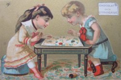
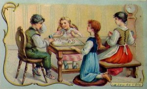
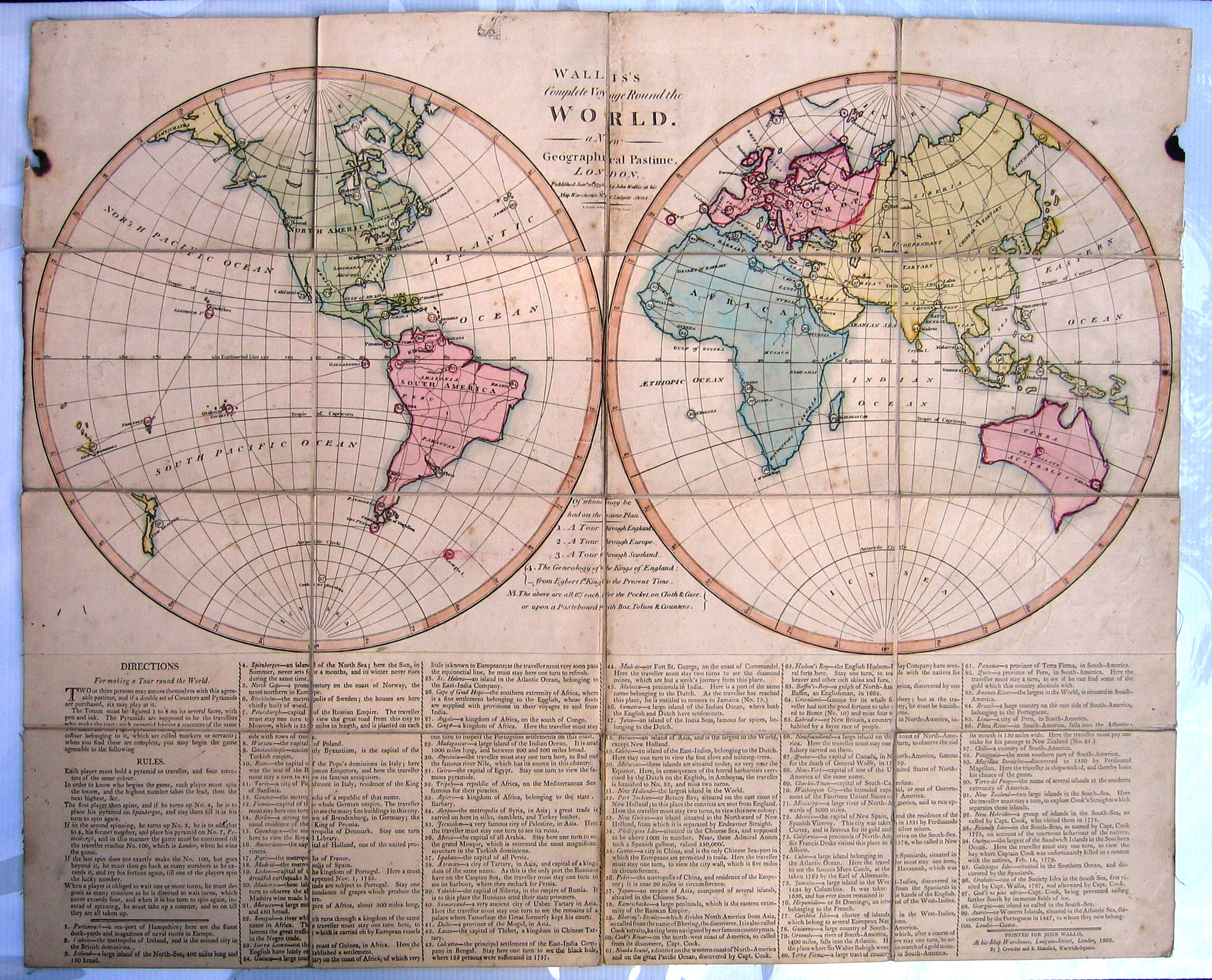
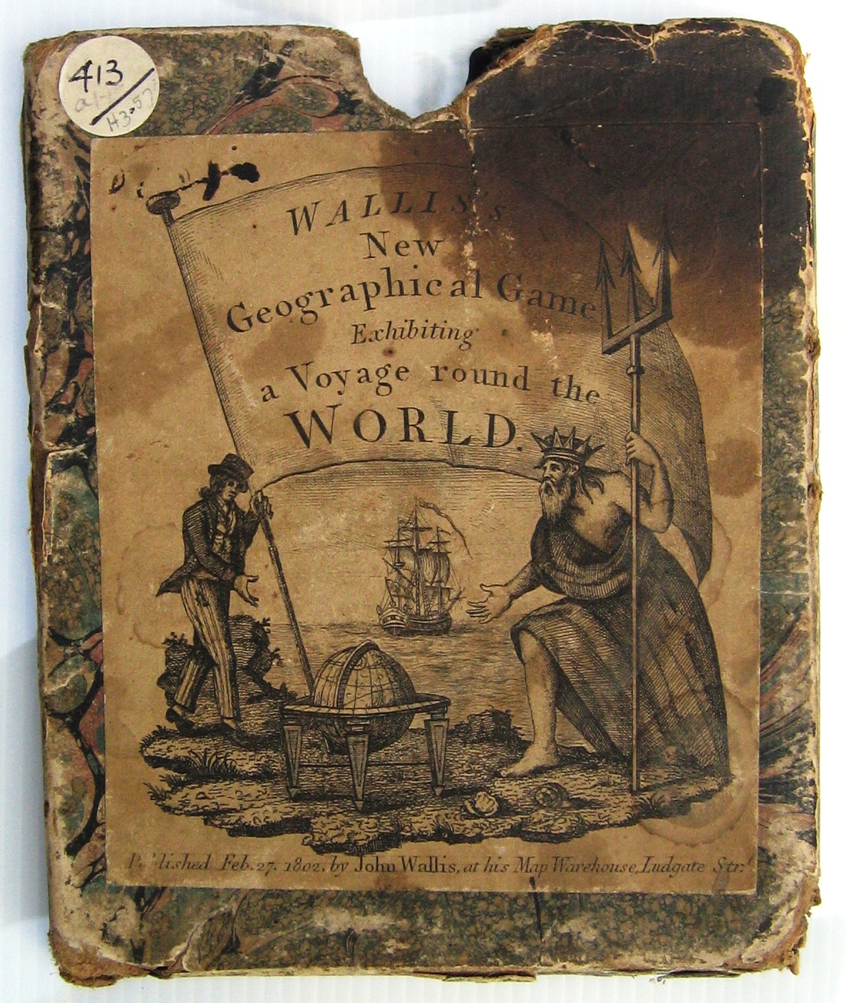
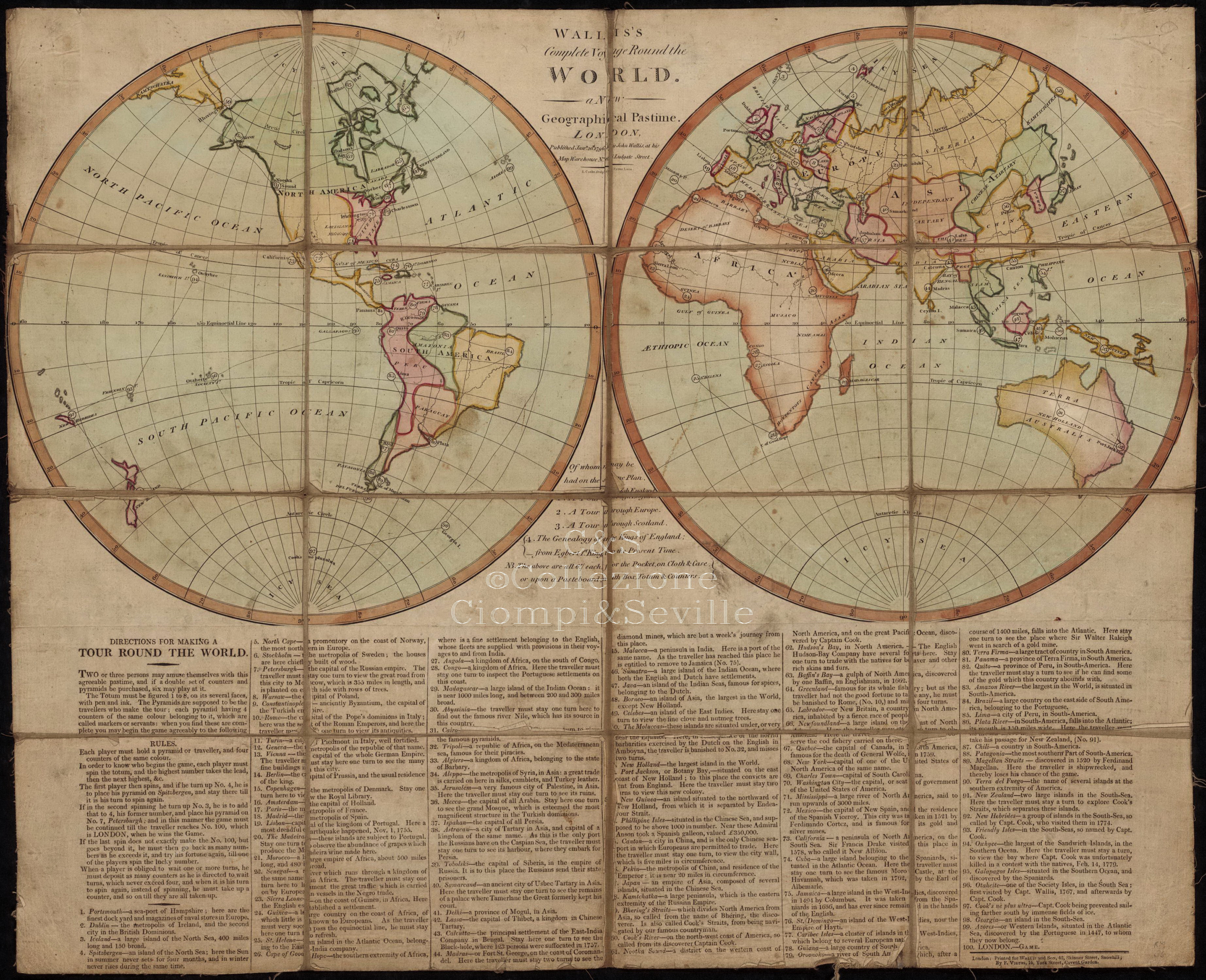
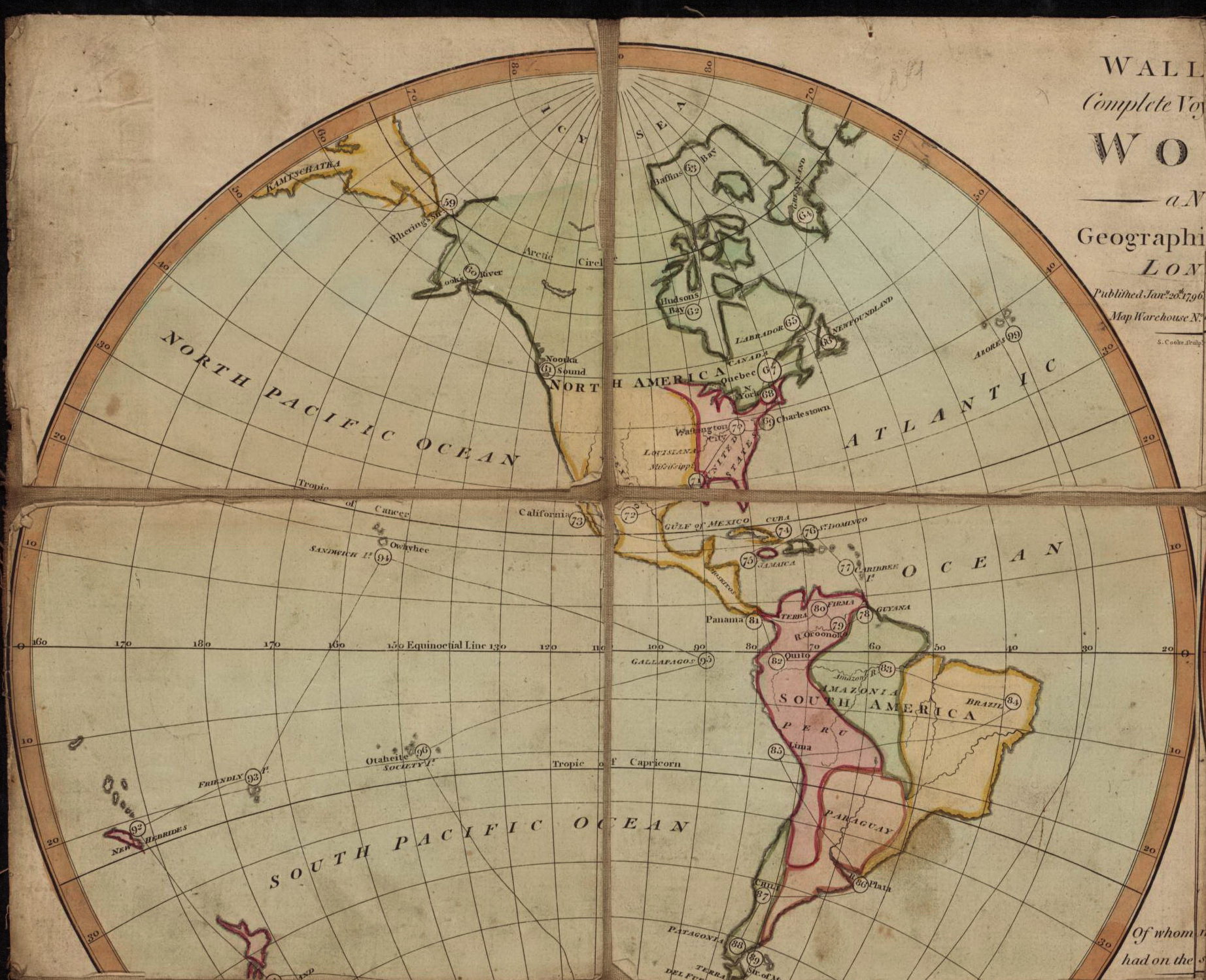
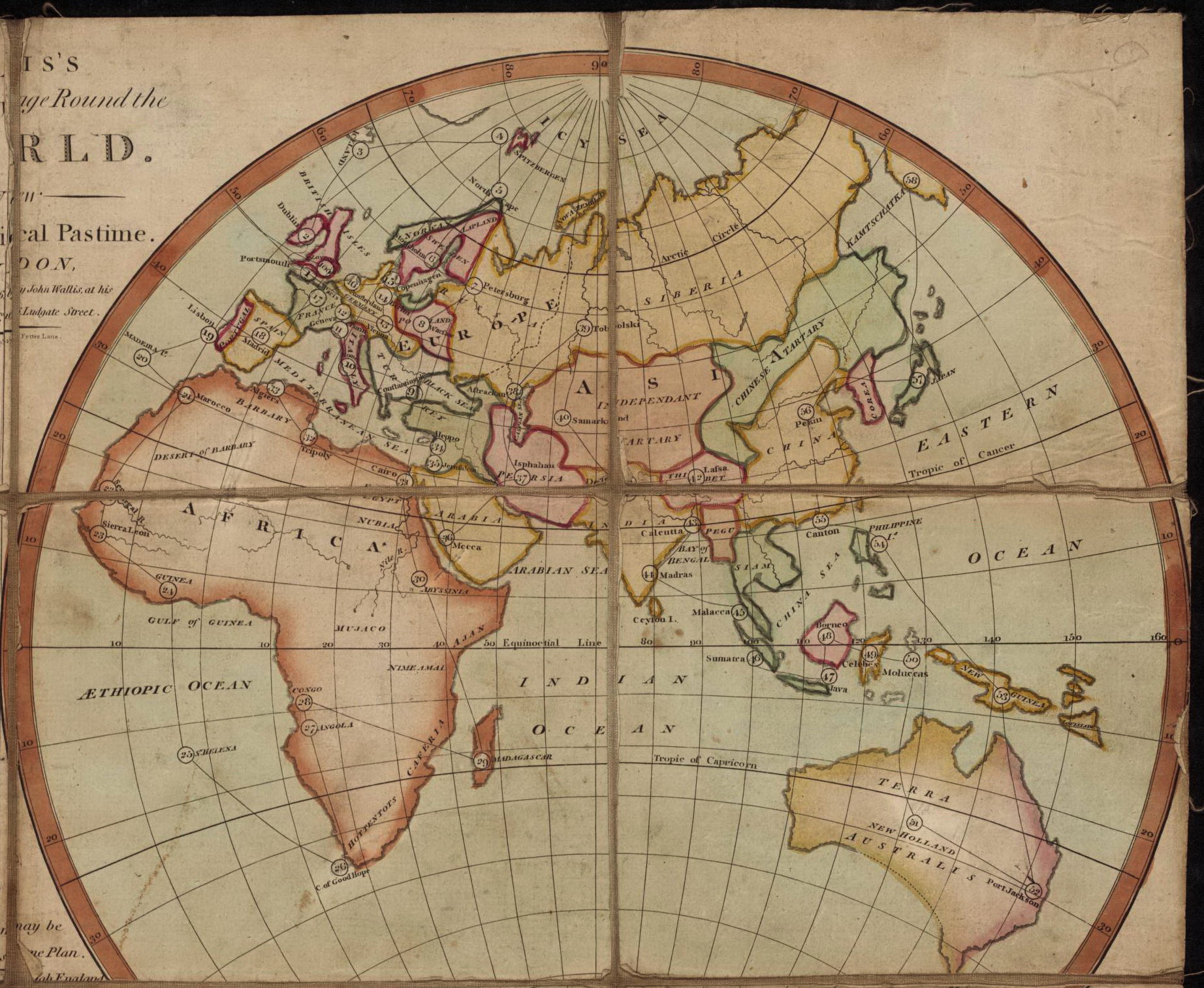
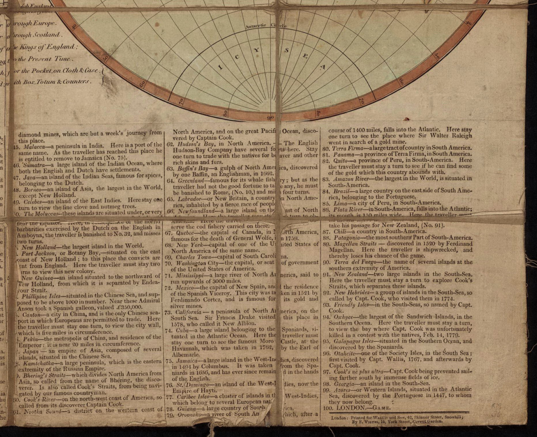
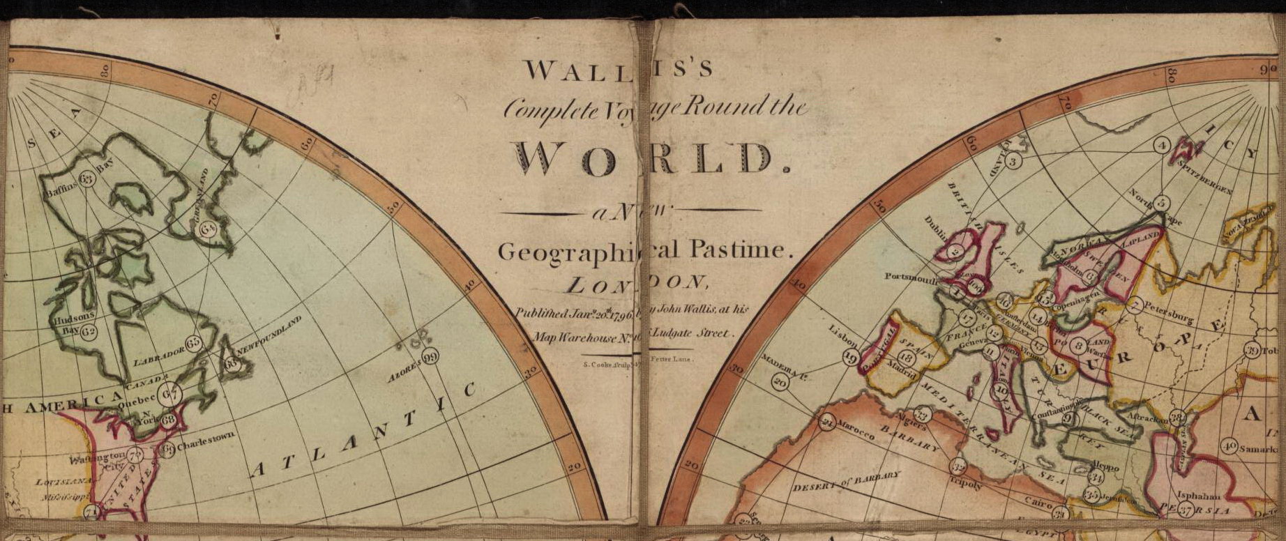
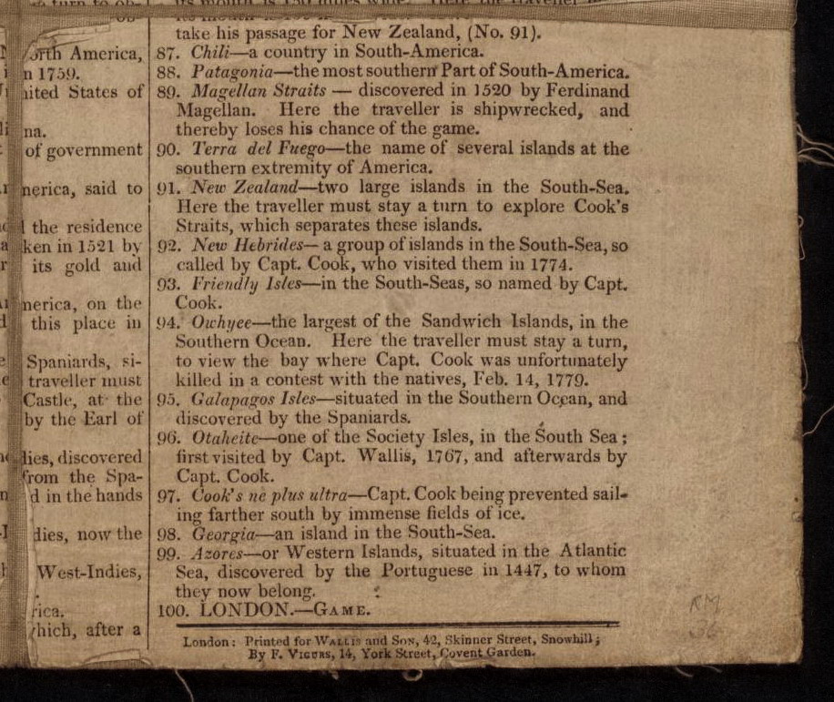
Gioco con 100 caselle distribuite sulla carta del mondo: partenza da Portsmouth e arrivo a Londra. Pubblicato nel 1796 viene ristampato nel 1802. REGOLE: in basso. CASELLE: mute. NOTA: Nell'esemplare della Collezione Seville descritto anche da Whitehouse si legge: "Published ... John Wallis at his Map Warehouse, N°16 Ludgate Street". "Printed for John Wallis, At his Map Warehouse, Ludgate Street, London, 1802. By J. Crowder and E. Hemsted, Warwick Square". REFERENZA 1 WHITEHOUSE, Francis Reginald Beaman, (pag. 10 - 11): WALLISS COMPLETE VOYAGE ROUND THE WORLD A new Geographical Pastime. London. Published Jan.y 20. 1796 by John Wallis at his Map Warehouse, N°16 Ludgate Street, "Of whom may be had upon the same plan. 1. A Tour through England. 2. A Tour through Europe. 3. A Tour through Scotland. 4. The Genealogy of the Kings of England, from Egbert 1st king to the present time. N .B. The above are all 6s. each for the Pocket, on cloth and case, or upon a Pasteboard with Box, Totum and Counters". An engraving, beneath which the rules printed from type are affixed, overall size 25 in X 20 in. Hand-coloured, cut into 16 sections and mounted on canvas. In the author's copy the rules printed by J. Crowder and E. Hemsted, Warwick Square, 1802 (6 years later than the game sheet). Starting at N°1 Portsmouth, the route travels the world, finishing at 100 London. Showing how little was known of the world south of the equator, the only town marked in New Holland (TERRA AUSTRALIA) is Port Jackson, the convict station on Botany Bay. In India, three towns are shown, viz. Calcutta (see the Black Hole, where 123 persons were suffocated in 1757-40 years ago), Delhi, Madras. No towns are shown on Africa south of the equator except "Cape of Good Hope where English fleets are supplied with provisions in their voyages to and from India". REFERENZA 2 Game 31: Complete Voyage Round the World Walliss Complete Voyage Round the World - a New Geographical Pastime. London: John Wallis at his Map Warehouse, 16 Ludgate Street, 1802. Copper engraving with original hand color, 51 x 65 cm, dissected and laid on linen in 4 x 4 panels. Ref.: Ciompi/Seville 1560; Whitehouse, pp. 10 -11. By the beginning of the 19th century, cartographic games were well established in England, with offerings from several London map makers, such as Robert Sayer, Laurie & Whittle, William Darton junior and Carington Bowles. The subjects of the games were no longer just based on the European Grand Tour; tours of England and Wales, Scotland, Ireland, and even the world were produced, and tours of France, Asia and the Americas soon followed. This example of a world tour game is by John Wallis and is dated 1796 on the map, though the pasted instruction sheet below is dated 1802. John Wallis (1745?1818) was one of the major publishers of childrens games and puzzles, as well as other printed items such as stationery, maps and music. The sheet makes it known that other games may be had on the same plan: all 6/- each for the Pocket, on Cloth and Case, or upon a Pasteboard, with Box, Totum and Counters, not an inconsiderable price, given that an average laborers daily wage in England in 1800 was about one third of that sum. Unlike the Complete Tour of Europe (Game 30), this game has little connection with Goose except for the use of a numbered track and moves determined wholly by chance. The departure is from Portsmouth and the voyage, following the numbered track marked on the two hemisphere maps, concludes at the winning space, London, numbered 100. The depiction of Terra Australis (New Holland, now Australia) is of interest. Tasmania is not shown as an island, though Flinders and Bass had proved that it was, in 1798/99. The only town marked is Port Jackson (Botany Bay, space 52), with reference to the English convict settlement there. Significant Goose spaces, such as death do not have counterparts in this map game; the nearest equivalent is the Magellan Straits (space 89), where "the traveller is shipwrecked and loses his chance of the game, recalling a similar rule in Game 30. This game very consciously speaks to Englands power and influence in the 18th century: - Sierra Leone (space 23), where the English have lately established a settlement - Cape of Good Hope (space 26), a fine settlement by the English, whose fleets are supplied with provisions on their voyages to and from India - Hudsons Bay (space 62), where the English have several forts. Stay one turn to trade with the natives for beaver and other rich skins and furs There is considerable detail of Captain Cooks exploratory voyages (from space 91), including his death at Owhyee (i.e., Hawaii, space 94) and the ne plus ultra (space 97, meaning no further) marking the Southern limit of his exploration. Past grievances are not forgotten. The Moluccas (Maluku) Islands (space 50) are remembered for the horrid barbarities exercised on the English by the Dutch in Amboyna, in reference to the torture and judicial execution in 1623 on Ambon Island of 20 English by agents of the Dutch East India Company, on accusations of treason. (The English alleged that confessions were extracted by an early form of water torture.) There is also reference to the Black Hole of Calcutta (space 43), where 123 persons were suffocated in 1757 - stay one turn! (Adrian Seville) REFERENZA 3 The game consists of the single sheet on which is printed two global views of the world - North and South America on the left, and Europe, Africa, Asia, and Australia on the right - with numbered locations on each of the continents. On the bottom third of the sheet are printed the directions for how to play the game "Directions for making a tour round the world", the rules, and the locations numbered 1-100 with one sentence descriptions of each place. The "new geographical pastime" is a game for 2-3 players. Beginning in Portsmouth and ending in London, England, the players spin the totum marked 1-8 [not supplied] and advance their pyramids [not included] to the numbered location on the map until circumnavigating the world from number 1 to 100. ("Trove - National Library of Australia ") Exhibitions: - "The Royal Game of the Goose four hundred years of printed Board Games". Exhibition at the Grolier Club, February 23 - May 14, 2016 (Prof. Adrian Seville). |
|
| bibliografia: |
1) WHITEHAUSE, F.R.B.: "Table Games of Georgian and Victorian Days", London, Peter Garnett, 1951. 2) GOODFELLOW, Caroline: "A Collector's Guide to Games and Puzzles". Secaucus, New Jersey, Chartwell Books-London, Quintet Publishing Limited 1991. 3) GOODFELLOW, Caroline: "The Development of the English Board Game, 1770-1850", in Board Games Studies 1, 1998. 4) GOODFELLOW, Caroline: "Jeux de société. Le guide du collectionneur des jeux de société depuis le XVIIIe siècle jusquà nos jours", (Edizione francese) Carrousel MS, 2001. 5) SEVILLE, Adrian: "The Game of Goose: and its influence on cartographical race games" Journal of the International Map Collectors' Society, Winter 2008 N°115 2008. 6) SEVILLE, Adrian: "The geographical Jeux de l'Oie of Europe." In "Belgeo" 2008 3-4 2008. 7) GOODFELLOW, Caroline: "How We Played: Games From Childhood Past", History Press, 2012. 8) CAPDEPUY, Vincent: "Le Monde en jeux", in "Histoire Globale", 2012. 9) QUINN, Brian - CARTWRIGHT, William: "Geographic Board Games". Geospatial Science Research 3. School of Mathematical and Geospatial Science, RMIT University, Australia. December 2014. 10) SEVILLE, Adrian: "The Royal Game of the Goose four hundred years of printed Board Games". Catalogue of an Exhibition at the Grolier Club, February 23 - May 14, 2016. 11) LIMAN, Ellen: "Georgian and Victorian Board Games: The Liman Collection", Pointed Leaf Press, 2017. 12) NORCIA, Megan A.: "Gaming Empire in Children's British Board Games, 1836-1860". Studies in Childhood, 1700 to the Present. Routledge, 2019. 13) SEVILLE, Adrian: "L'arte dei giochi da tavolo. Oltre un secolo di storia e divertimento dalla fine del Settecento all'inizio del Novecento." Edizioni White Star, 2019. 14) PARLAK, Omer Fatih: "Seafearing through the Perspective of Historic Board Games", in DGSM, Köllen Druck+Verlag, Bonn 2020. 15) SEVILLE, Adrian - DEPAULIS, Thierry - BEKKERING, Geert H.: Playing with Maps: Cartographic Games in Western Culture. Brill Research Perspectives, Leiden-Boston, 2023. |
|
| "The Development of the English Board Game, 1770-1850" (Caroline G. Goodfellow) | ||
| Geographical Games. "Table Games of Georgian and Victorian Days". (Francis Reginald Beaman, Whitehause) | ||
Vai alla ricerca giochi Vai all'elenco autori