Giochi dell'Oca e di percorso
(by Luigi Ciompi & Adrian Seville)
(by Luigi Ciompi & Adrian Seville)

|
Giochi dell'Oca e di percorso
(by Luigi Ciompi & Adrian Seville) |

|
 |
Torna alla ricerca giochi (back to game search) |
 |
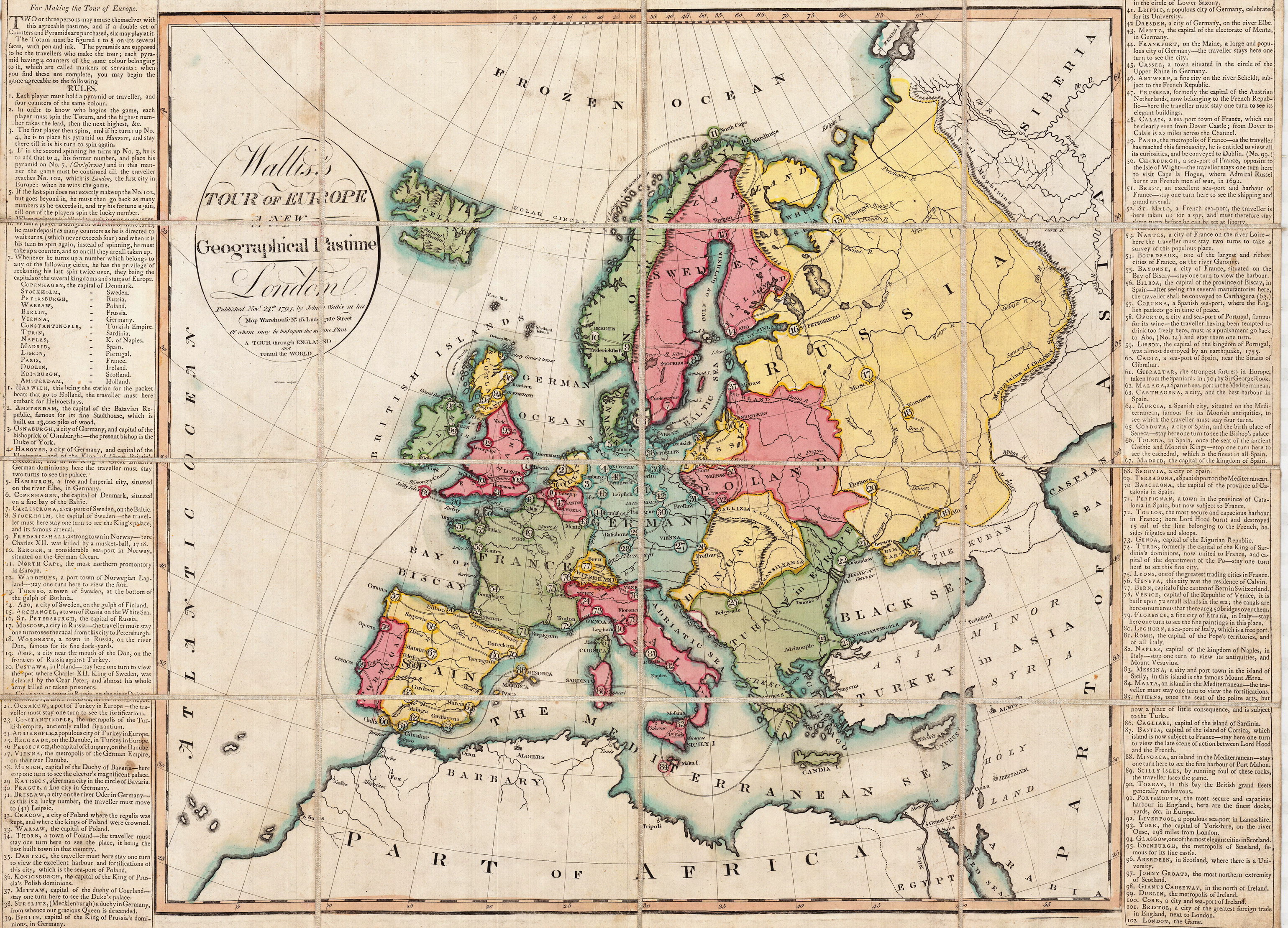
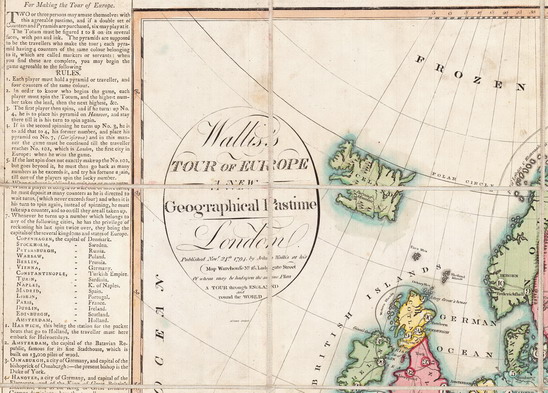
| Wallis's Tour of Europe. A New Geographical Pastime | ||
 |
Versione stampabile
 |
Invia una segnalazione

|
           |
primo autore: | Anonimo |
| secondo autore: | Wallis | |
| anno: | 1794 | |
| luogo: |
Inghilterra-Londra |
|
| periodo: | XVIII secolo (4°/4) | |
| percorso: | Percorso di 102 caselle numerate | |
| materiale: | carta incollata su tela (engraving on paper with linen backing) | |
| dimensioni: | 482X690 | |
| stampa: | Litografia colorata a mano (hand-coloured engraving) | |
| luogo acquisto: | Germania | |
| data acquisto: | 24-04-2019 | |
| dimensioni confezione: | 180X130 | |
| numero caselle: | 102 | |
| categoria: | Geografia | |
| tipo di gioco: | Gioco di percorso | |
| editore: | Published Nov 24 1794 by John Wallis at his Map Warehouse No 16 Ludgate Street | |
| stampatore: | Wallis John | |
| proprietario: | Collezione A. Seville - L. Ciompi | |
| autore delle foto: | A. Seville - L. Ciompi | |
| numero di catalogo: | 1772 | |
| descrizione: |
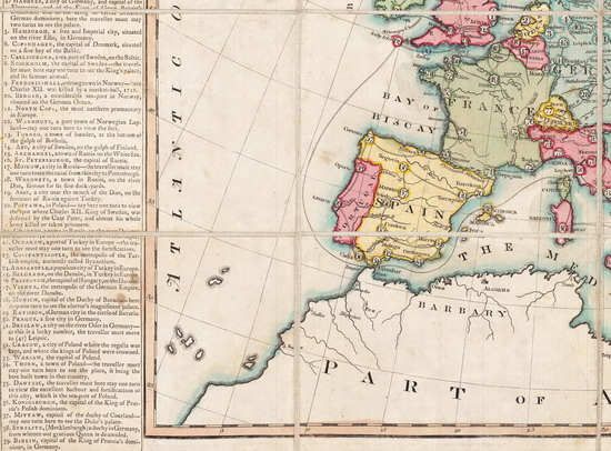
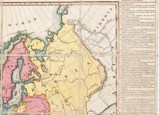
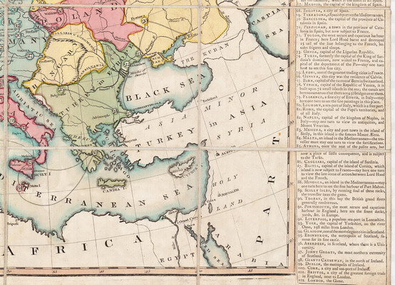
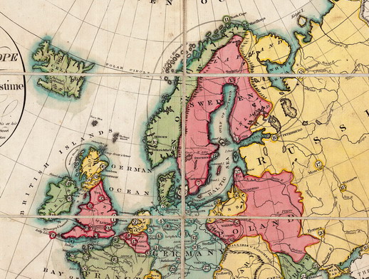
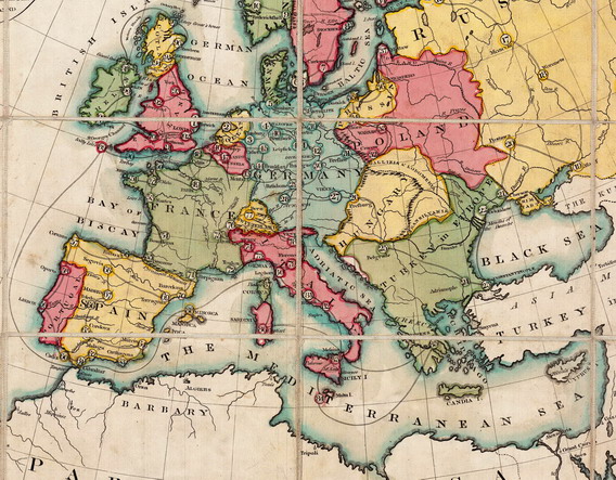
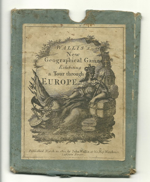
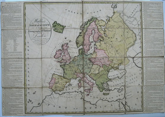
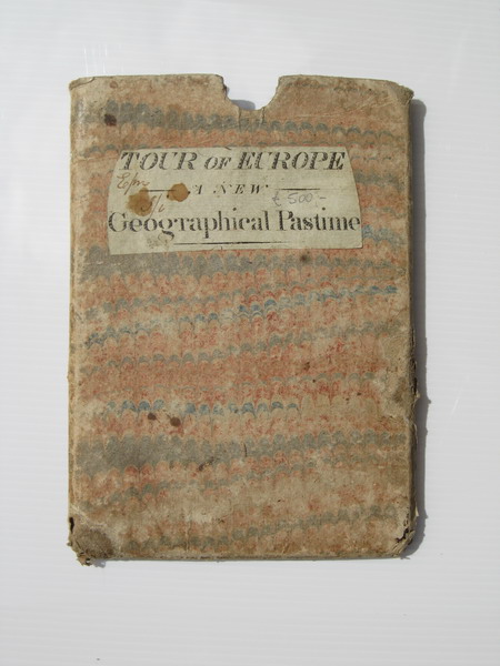
Gioco di 102 caselle numerate distribuite sulla carta geografica dell'Europa, ristampato nel 1802/11 e molto probabilmente altre volte e con colorazioni diverse. Partenza da Harwich e arrivo a Londra ("the first city in Europe"). Vedi anche esemplare nella Collezione E. C. (Arch. n°1211) REGOLE: a destra e sinistra del tavoliere. CASELLE: senza didascalia. REFERENZA 1 "Wallis's Tour of Europe A New Geographical Pastime. Published by John Wallis in London in 1794. Dissected and laid on linen. First Edition of this famous map-game, which was reprinted in 1802/1811 (and probably at other times). A rare specimen of the craze for educational games that swept Europe and Great Britain in the late 18th and early 19th centuries, this highly attractive map is the game board for an edifying tour of the leading cities of the Continent and the British Isles. The players use a 'totum' and "pyramids or travellers" to compete: each player in turn rolls the totum and moves his piece along a route of numbered cities and locations, the final goal being arrival in London, "the first city in Europe." In addition to the luck of the roll, players must cope with delays in some cities; in Florence a Traveller must "stay here one turn to see the fine paintings in this place", and disasters elsewhere, if a player lands on the Scilly Islands, "by running foul of the rocks, the Traveller loses the game." All editions of this work are uncommon." (in: bibliodyssey.blogspot) REFERENZA 2 WHITEHOUSE, Francis Reginald Beaman, (pag. 8): WALLIS’S TOUR OF EUROPE a new Geographical Pastime, London. Published Nov 24 1794 by John Wallis at his Map Warehouse No 16 Ludgate Street of whom may be had upon the same plan A TOUR THROUGH ENGLAND and ROUND THE WORLD. An engraving of a map of Europe with the rules printed from type and affixed either side of the map: size in all 27 ¾ in X 19 ¼ in. Cut into 16 sections and mounted on white canvas. Contained in a slip case. The First Editions have an oval label printed in black from an engraved plate pasted to the outside of the case: subsequently rectangular ones with a scroll surmounted with a crown and flags were used with a Cannon, Drum and Anchor in the background. On the author’s copy of this game the colouring is as brilliant as when applied with a brush over 150 years ago, and most accurate in its outlines. Starting at No 1 Harwich players tour Europe and finish at 102 London. One of the later editions of this game was printed from the original plate but with all the sea areas denoted by horizontal lines. This particular edition was published 13th March, 1811 by John Wallis at his Map Warehouse 13 Warwick Square, not 16 Ludgate Street as in early editions. The rules no longer appear alongside the map, but are printed in a separate booklet, whose imprint is E. Wallis, 42, Skinner Street, Snow Hill, and printed by T. Davis, 102 Minories. REFERENZA 3 "Wallis produisit en parallèle "Tour of Europe" (Le tour d'Europe) qui fut lui aussi édité en 1794, portant la date du 24 novembre. Il se compose de 16 sections montées sur toile de lin et presente 102 villes, dont certaines étaient les capitales des "royaumes et Etats" d'Europe. Tomber sur l'une d'elles permettait de doubler le trajet précédant. Chaque description insiste sur ce qui devrait etre vu dans chaque ville et certains rappellent des faits ou des sites militaires tels que batailles, arsenaux et fortifications. Le Tour de l'Angleterre et du pays de Galles et le Tour d'Europe sont tous deux révélateurs de ce qui était alors considéré comme commercialement et historiquement important. Bien entendu, ces jeux furent produits à l'échelle du Grand tour de l'Europe et on y avait inclus tout ce que l'on pensait etre intéressant." (GOODFELLOW Caroline) REFERENZA 4 "Wallis produced a companion "Tour of Europe" which was also published in 1794 and it bears the date November 24th, 1794. Likewise it was a hand-coloured engraving il 16 sections mounted on linen. This shows 102 towns, some of which were capitals of the "kingdoms and states" of Europe, and landing on one of these brings the privilege of doubling the last spin. Most of the descriptions stress what might be seen in each town, and some reflect military activities such as battles, arsenals and fortifications. Both the "Tour of England and Wales" and the "Tour of Europe" give an insight into what was currently regarded as historically and commercially important. Of course, these games were published at the height of the Grand Tour of Europe, and all that was thought to be best was included." (GOODFELLOW Caroline) REFERENZA 5 Wallis’s Tour of Europe, A New Geographical Pastime, London: John Wallis, 1794, 71 x 49 cm. (Yale University GV1199 .W352 1794). HOW TO PLAY THE GAME: This geographic game includes stops for all the cities someone might visit while on a tour of Europe. The game begins in Harwich (1), a major port on the eastern coast of England where many tourists would take a packet boat to the continent. Players of Wallis’s game would spin a teetotum (also called a “totum” as here) to move their markers along the route, occasionally losing a turn or two to learn about some local attraction on their way back to London (102), the last stop. Or, if they were lucky enough to land on Paris (49), for example, players were “entitled to view all its curiosities” and skip ahead, all the way to Dublin (99). Close to home, the most dangerous stop was the Scilly Isles (89, just off the coast of Cornwall in southwest England), where, “by running foul of the rocks, the Traveller loses the game.” (Patrons) Exhibitions: - "Instruction and Delight: Children's Games from the Ellen and Arthur Liman Collection" (Yale Center for British Art, 17 January-23 May, 2019). |
|
| bibliografia: |
1) WHITEHAUSE, F.R.B.: "Table Games of Georgian and Victorian Days", London, Peter Garnett, 1951. 2) GOODFELLOW, Caroline: "A Collector's Guide to Games and Puzzles" Secaucus, New Jersey, Chartwell Books-London, Quintet Publishing Limited 1991. 3) GOODFELLOW, Caroline: "The Development of the English Board Game, 1770-1850", in Board Games Studies 1, 1998. 4) GOODFELLOW, Caroline: "Jeux de société. Le guide du collectionneur des jeux de société depuis le XVIIIe siècle jusqu’à nos jours", (Edizione francese) Carrousel MS, 2001. 5) SEVILLE, Adrian:"The Game of Goose: and its influence on cartographical race games" Journal of the International Map Collectors' Society, Winter 2008 N°115 2008. 6) SEVILLE, Adrian:"The geographical Jeux de l'Oie of Europe." In "Belgeo" 2008 3-4 2008. 7) GOODFELLOW, Caroline: "How We Played: Games From Childhood Past", History Press, 2012. 8) LIMAN, Ellen: "Georgian and Victorian Board Games: The Liman Collection", Pointed Leaf Press, 2017 (pages 138). 9) NORCIA, Megan A.: "Gaming Empire in Children's British Board Games, 1836-1860". Studies in Childhood, 1700 to the Present. Routledge, 2019. |
|
| "The Development of the English Board Game, 1770-1850" (Caroline G. Goodfellow) | ||
| Geographical Games. "Table Games of Georgian and Victorian Days". (Francis Reginald Beaman, Whitehause) | ||
Vai alla ricerca giochi Vai all'elenco autori