Giochi dell'Oca e di percorso
(by Luigi Ciompi & Adrian Seville)
(by Luigi Ciompi & Adrian Seville)
|
Giochi dell'Oca e di percorso
(by Luigi Ciompi & Adrian Seville) |
|
|
 |

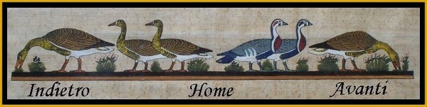
Torna alla ricerca giochi (back to game search) |
 |
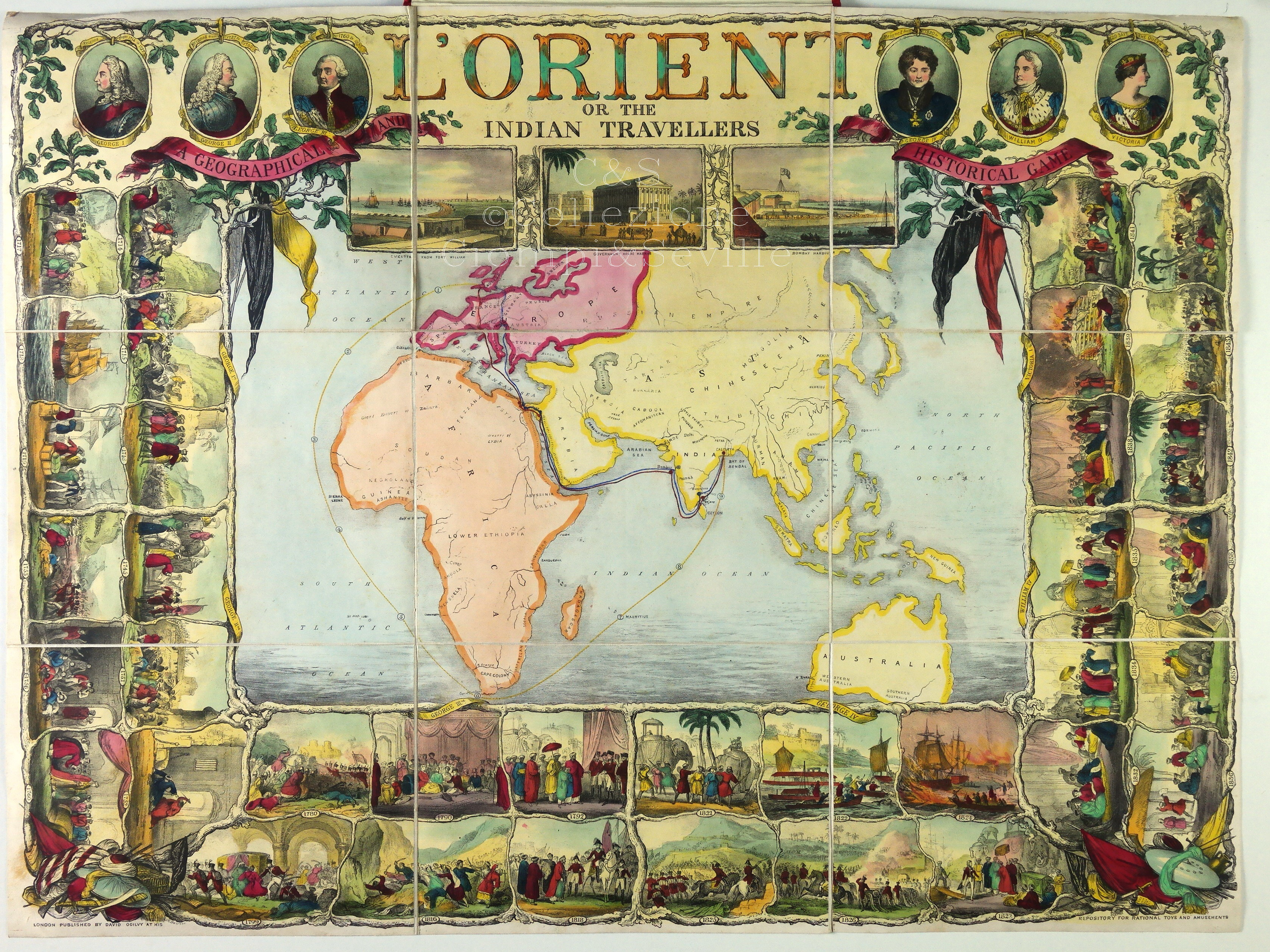
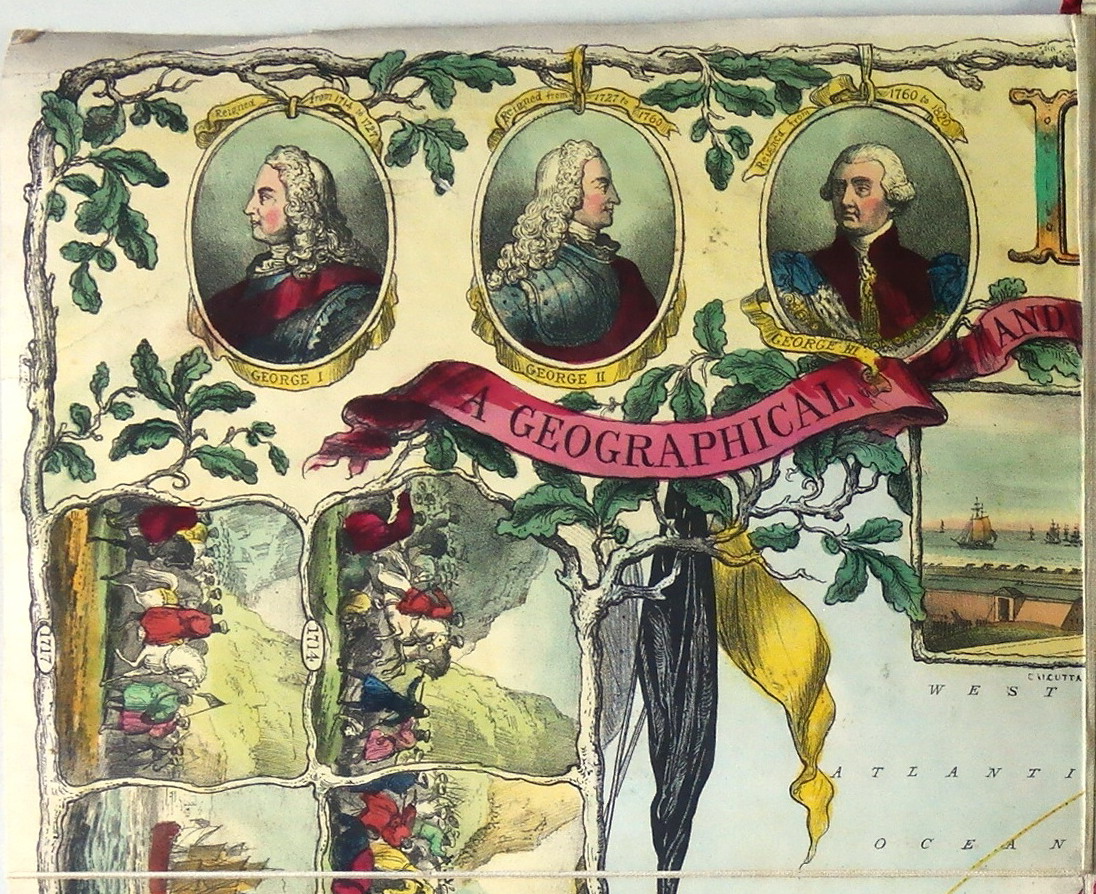
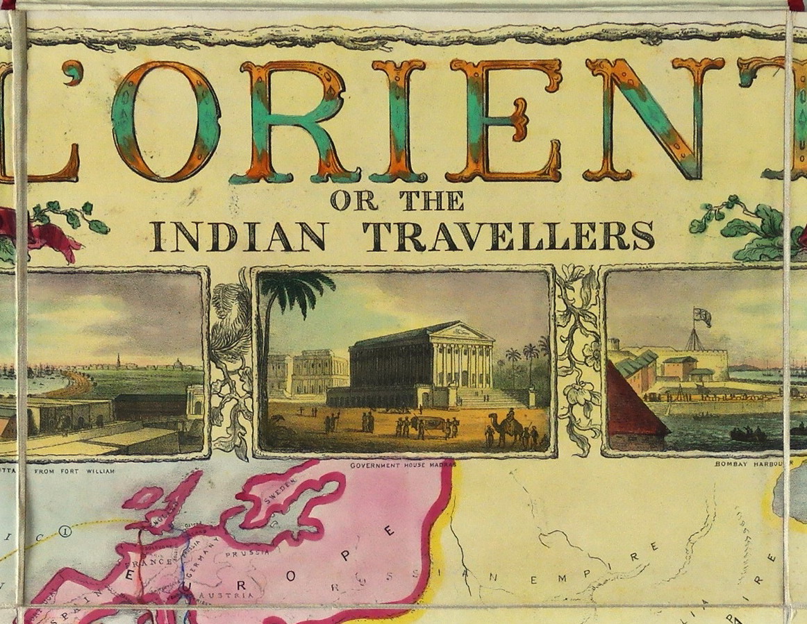
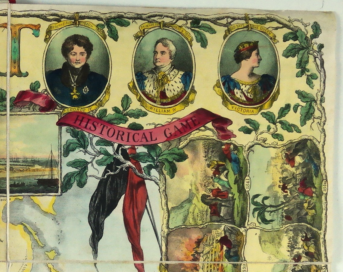
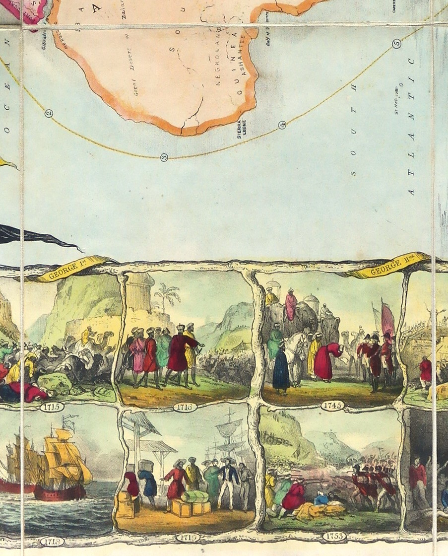
| Orient (L') or the Indian Travellers | ||
 |
Versione stampabile
 |
Invia una segnalazione

|
 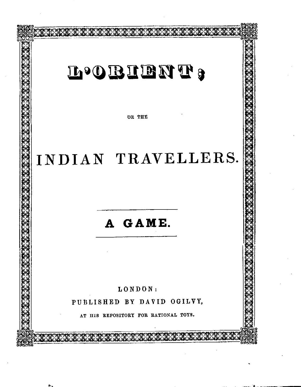                   |
primo autore: | Barfoot James Richard |
| secondo autore: | Ogilvy David | |
| anno: | 1846 | |
| luogo: |
Inghilterra-Londra |
|
| periodo: | XIX secolo (2°/4) | |
| percorso: | Percorso di 36 caselle numerate | |
| materiale: | carta incollata su tela (engraving on paper with linen backing) | |
| dimensioni: | 555X745 | |
| stampa: | Litografia colorata a mano (hand-coloured etching) | |
| luogo acquisto: | ||
| data acquisto: | ||
| dimensioni confezione: | ||
| numero caselle: | 36 | |
| categoria: | Geografia | |
| tipo di gioco: | Gioco di percorso | |
| editore: | Published by David Ogilvy | |
| stampatore: | Lithograph after J. R. Barfoot | |
| proprietario: | Collezione A. Seville | |
| autore delle foto: | A. Seville | |
| numero di catalogo: | 2443 | |
| descrizione: |
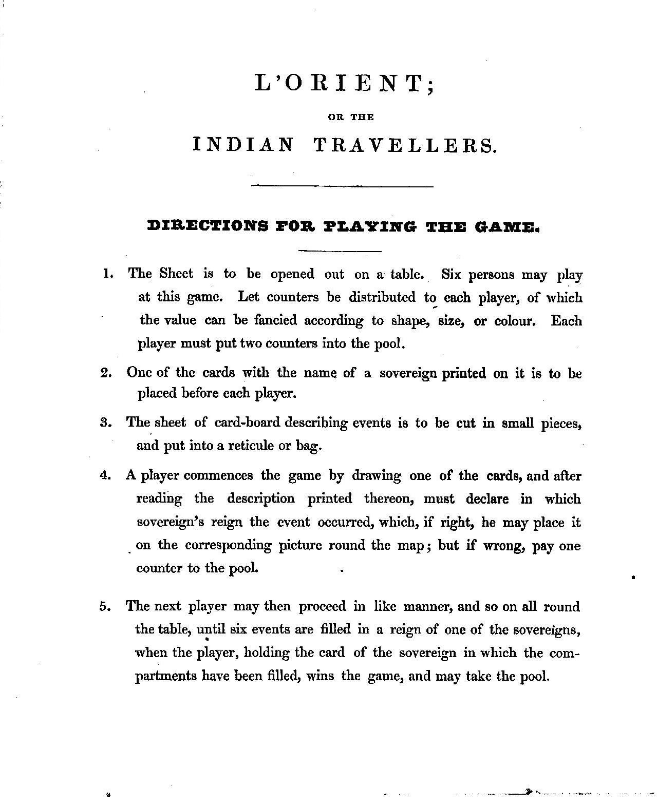
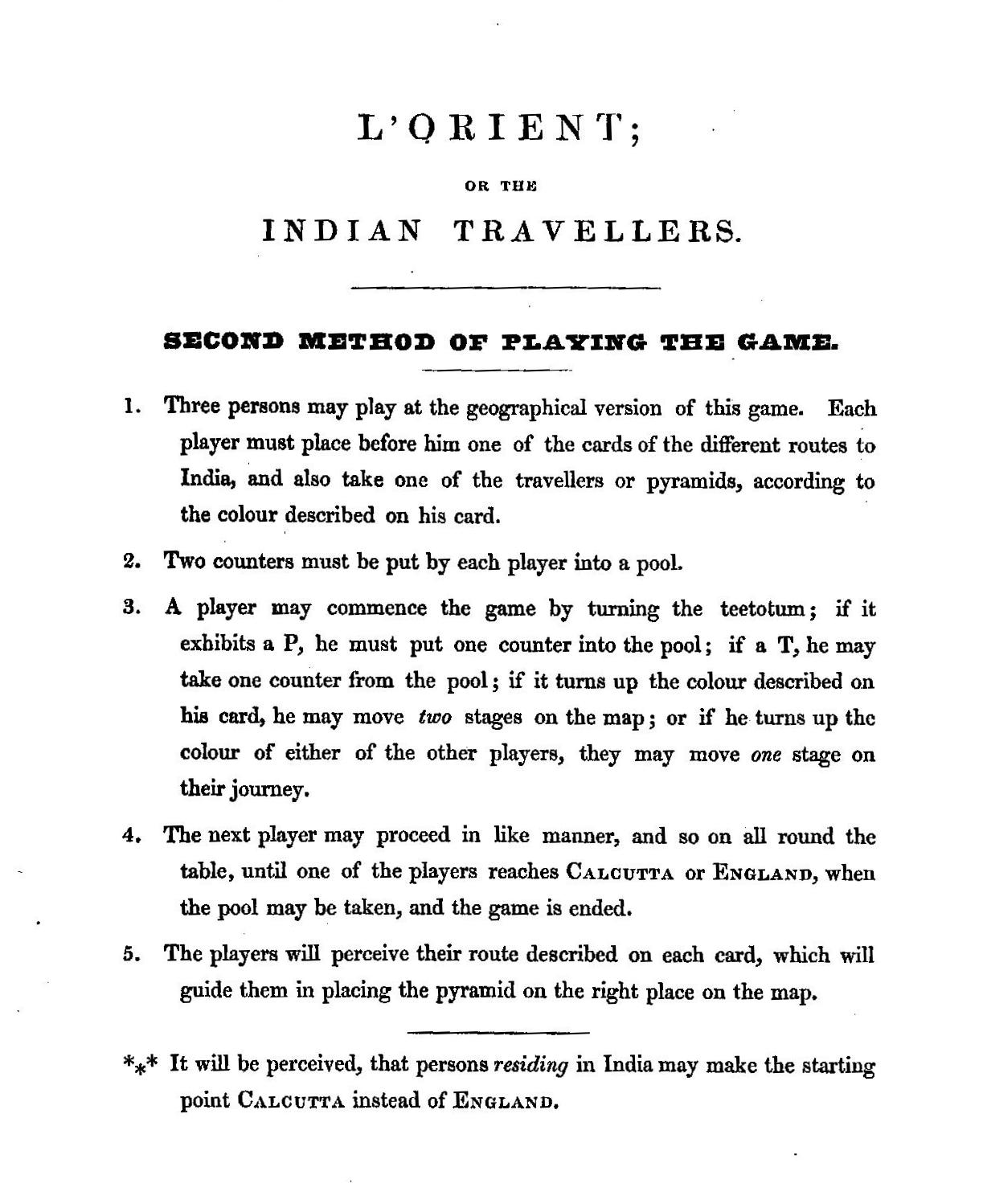
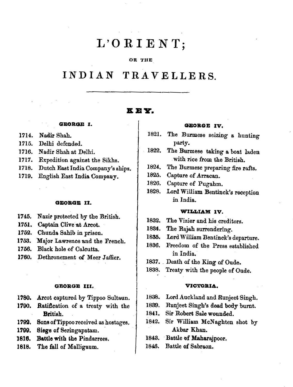
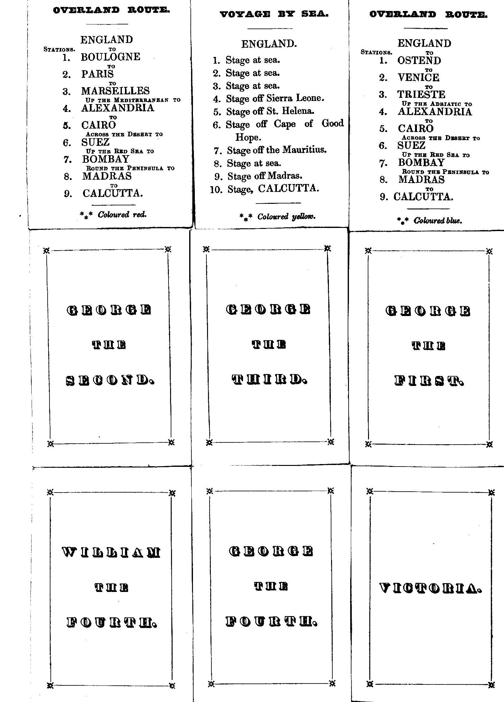
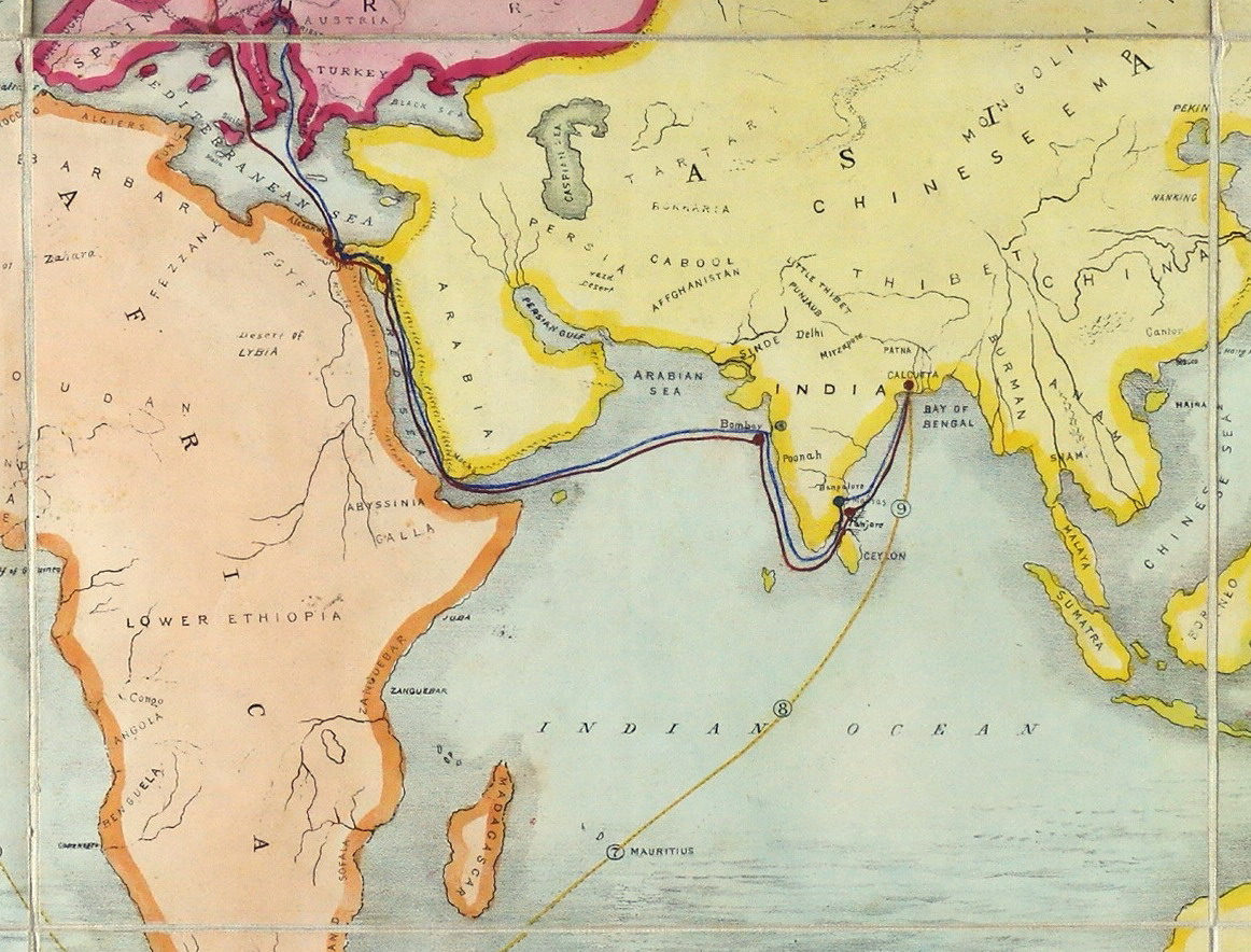
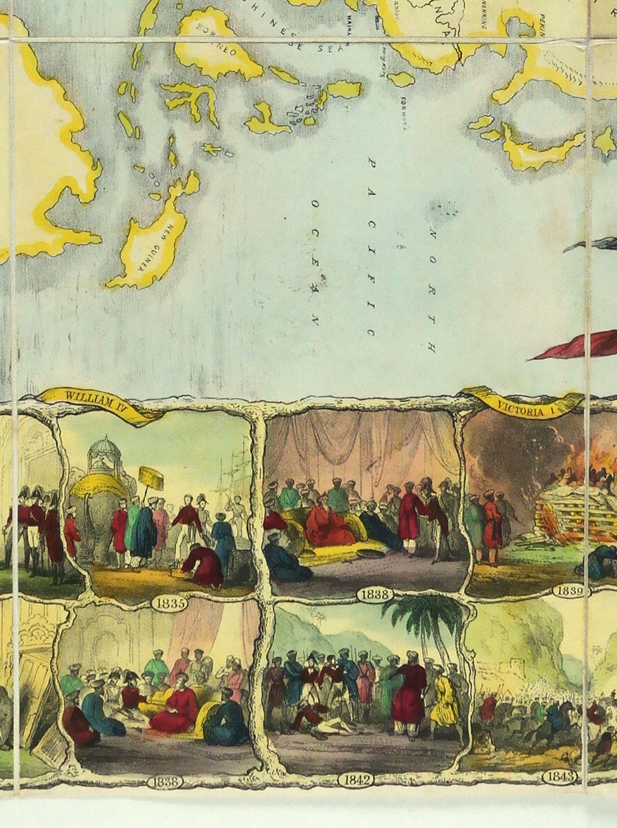
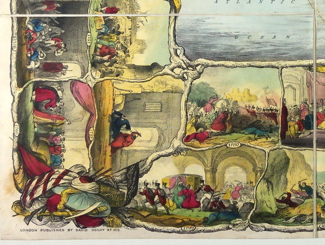
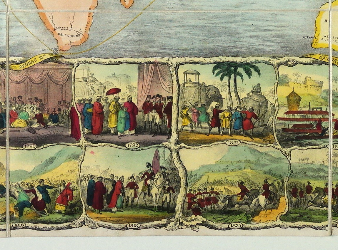
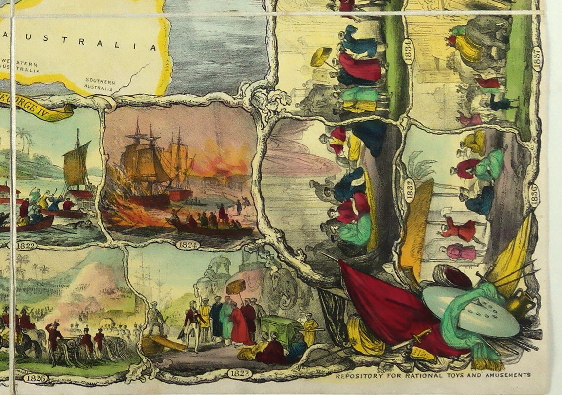
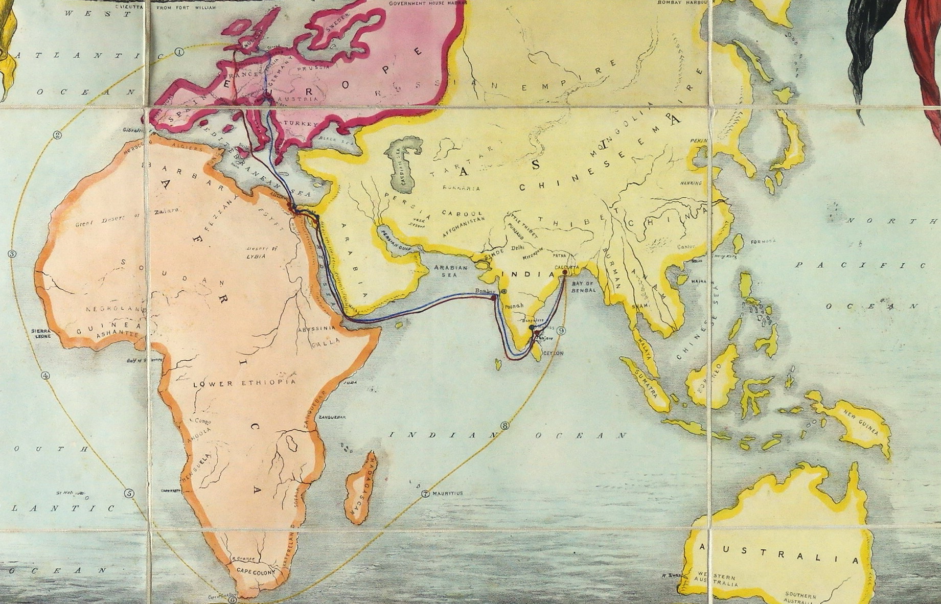
Gioco di 36 caselle numerate. "L'Oriente o i Viaggiatori Indiani" è uno dei migliori giochi prodotti a Londra nel XIX secolo. Il disegno è di grande qualità (fu realizzato molto probabilmente da un artista poco noto , J. W. Barfoot, R. A.) ed è colorato in maniera molto meticolosa come si addiceva ad una fascia alta del mercato. In realtà si tratta di due giochi in uno: le scene su entrambi i lati e sotto l'immagine centrale mostrano eventi della storia dell'India, soprattutto da un punto di vista inglese. Ciascun giocatore sceglie uno dei sovrani illustrati sopra la mappa. Poi a turno si prelevano da un sacchetto delle carte con degli eventi. Il giocatore deve quindi nominare sotto quale sovrano è avvenuto il fatto e se la risposta è corretta può piazzare la carta sull'immagine corrispondente a quell'evento. Ci sono sei episodi per ogni regnante: vince il giocatore che rappresenta il sovrano che avrà tutti gli eventi coperti per primo. Il secondo gioco è una gara lungo uno dei tre percorsi indicati sulla mappa: via terra passando per Marsiglia (rosso), via terra passando per Trieste (giallo) o via mare navigando attorno al Capo di Buona Speranza. Il gioco è controllato da una trottola con lati colorati che fa avanzare il giocatore sul percorso a seconda del colore che uscirà. Secondo le regole la persona che risiede in India può iniziare da Calcutta invece che da Londra, dimostrando ancora di più come si trattasse di un gioco creato al culmine dell'era coloniale britannica. REGOLE: non riportate sul tavoliere (allegate). CASELLE: mute. REFERENZA 1 "LOrient or the Indian Travellers".(V&A Museum). Physical description Design: hand coloured etching, 9 panels mounted on linen N°of squares: 36 Squares illustrated: all Square numbering: all Squares titled: 9 Subject of starting square: 1714 Subject of ending square: 1845-6 Place of Origin: London Date: 1845-1847 Object history note: David Ogilvy was at 27 Hunter Street, Brunswick Square until about 1845 then until 1847 at 12 Rathbone Place. After this date the lithographers L'Enfant Brothers were at the address. The last date is partly obliterated and is either 1845 or 1846; the game will have been published by 1847. There is a price marked on the cover which is consistent with the cost of such a game at the time, 6/6. Historical context note Rewards: extra turns, forward movement Forfeits: missed turns, backward movement N°of Players: any Equipment required: game markers and counters booklet Rules: The game is a hand coloured etching, 9 panels mounted on linen. The title is across the top and the publisher's details at the bottom. The game is in three parts. At the top are medallions, each showing a portrait of sovereign from George l to Victoria with the dates of their reigns. The central part of the game is a map of Europe, Africa and Asia with three sailing routes from England to India; one route is numbered and major cities are shown. Around three sides of the game are 36 squares in two layers. Each square is dated and illustrated and linked by a tree root design in sets of 3 pairs. The starting date is 1714 and the finishing one 184? with the last number obliterated - it may be 1845 or 1846. Below the title ae three illustrations of prominent Indian towns, Calcutta, Bombay and Madras. There is no booklet and the rules were probably written in it. The game is probably played with a teetotum and markers. The players move from one square to another, must read out the details found in the booklet and match the event illustrated and sovereign. Attached to the top centre panel is a card folder into which folds the game. It is covered with dark red embossed cloth and stamped in gold with the title. To the upper right is a price 6/6. This may be the original price as it is consistent with the average cost of these games at the time. Rules placement: booklet REFERENZA 2 L'Orient or the Indian Travellers, a Geographical and Historical game. London, Published by David Ogilvy at his repository for rational toys and amusements. Linen backed printed and hand coloured with map to centre showing Europe, Africa, Asia and Australia, bordered by 36 dated stops depicting historical scenes from 1714 to 1845/6, the top with six portraits from King George I to Victoria and three scenes showing Calcutta from Fort William, Government House Madras and Bombay harbour, 74.5x55.5cm (29 1/4 x21 3/4 in). (Bonhams) REFERENZA 3 WHITEHOUSE, Francis Reginald Beaman, (pag. 23): LORIENT or the Indian Travellers. London. Published by David Ogilvy at his Repository for Rational Toys and Amusements (not dated). A lithograph after J. R. Barfoot, size 22 in X 29 ½ in, mounted on linen and folded into cloth covers with title L'Orient or The Indian Travellers". A geographical and historical game comprising a map of Africa, Europe, Asia and Australia, with small views of Calcutta, Government House, Madras", Bombay Harbour", half-length portraits of Kings and Queens and 36 illustrations of Indian Historical Events from 1714-1846. REFERENZA 4 LOrient or the Indian Travellers - Der Orient oder: Die Indienfahrer London, 1845-1847 Radierung, handkoloriert, 55,5X74,5 cm Verlag: David Ogilvy Sammlung: Victoria and Albert Museum, London (Inv. Nr.: B.11-1997) Spiele sind von Weltanschauungen gepraegt und sie praegen unsere Weltanschauungen. Die spielerische Reise in LOrient or the Indian Travellers fuehrt sowohl durch den Raum als auch durch die Zeit, die Reise geht von London bis Beijing, der Zeitraum, den das Spiel auf seinen Feldern erschliesst, reicht vom Beginn des 18. Jahrhunderts bis in die 1840er-Jahre. In diesem Zeitraum wird auch der titelgebende Begriff des Spiels, der ",Orient", massgeblich entworfen und die Idee geschaffen, der Orient bilde eine Art Einheit, die sich grundlegend vom "Okzident unterscheide. Bis heute wird die Funktion von Spielen in diesem Prozess unterschaetzt, wie andere Medien zeichnen auch sie mit an den imaginaeren Landkarten in den Koepfen der Menschen. Darstellungen wie in LOrient "orientalisieren den Orient" (Edward W. Said), sie verwandeln die disparate kulturelle Vielfalt zwischen der Levante und China in eine einheitliche Gegenwelt zu Europa, gleichermassen begehrt wie gefuerchtet. Spiele produzieren vielleicht nicht diese Bilder, aber sie stuetzen die kulturelle Hegemonie bestimmter, bereits existenter geopolitischer Vorstellungen und Fantasien, in diesem Fall von "Europas kollektivem Tagtraum vom Orient" (V. G. Kiernan). Durch diesen Traum, durch die Behauptung der Existenz eines Gegenstuecks, gewinnt Europa Identitaet - und ueber lange Zeit auch die Legitimitaet zur Kolonialisierung. Aufbau und Symbolik von LOrient or the Indian Travellers sind eine Feierstunde des britischen Empire zu Beginn der Regentschaft von Koenigin Viktoria: Ganz oben, ueber dem eigentlichen Spielplan,prangen je drei Portraets der englischen Koenige und Herrscherinnen, darunter sind in der Mitte unter dem Titel drei Stadtansichten von Kalkutta, Bombay und Madras zu sehen. Vier unterschiedliche Reiserouten fuehren auf der zentralen Landkarte des Spiels von London nach lndien und weiter nach China. Umgeben ist die Karte von 36 Feldern, die eine koloniale Geschichte des oder Geschichten vom Orient erzaehlen. Jedes Feld ist von unregelmaessigen organischen Formen umgrenzt, bei genauerem Hinsehen erweisen sie sich als Astwerk eines wohl uralten Baumes. Die Aeste verbinden die einzelnen Felder zu einem Ganzen, Banderolen mit den Namen der englischen Koenige umranken den Baum, der nach wie vor zu wachsen scheint, zwar keine Fruechte, aber doch Blaetter traegt. Wer ist der "lndian Traveller", der Protagonist der Erzaehlung und Adressat des Spiels? Wohl nicht der englische Gentleman Phileas Fogg aus Jules Vernes Reise um die Erde in achtzig Tagen, der fuer einen vertieften Blick in die Geschichte keine Zeit hat und am Kulturellen nicht sonderlich haengt. Eher scheint das Spiel an den englischen Tradesman gerichtet, wie ihn Daniel Defoe wenige Jahre nach Robinson Crusoe im Jahr 1726 in seiner Schrift The Complete English Tradesman als den wahren Herrscher der Zukunft entwirft. Der neue Tradesman vereint die moralischen Standards der englischen Gentry und den neuen Unternehmergeist des Handels. Nach Defoe ist eine "greater race" im Entstehen begriffen, der niemand widerstehen kann und die enormen Reichtum akkumulieren wird. Durch Reisen (und nicht durch Lektuere) vervollstaendigt der englische Tradesman seine Erfahrung. Via Spiel darf er diese von daheim aus machen und sich in Text und Bild den eigenen Anspruch und die eigene Superioritaet vor Augen fuehren. Das Regelwerk des Spiels ist (wie das Kolonialreich England) im Laufe der Zeit verloren gegangen. Die Regeln des Spiels muessten also heute neu verfasst werden, Der Fantasie der Spieler sind keine Grenzen gesetzt. Ein Hinweis dazu: Die Reise verliefe wohl, betrachten wir die Migrationsstroeme zu Beginn des 21. Jahrhunderts, in umgekehrter Richtung. Sie ist fuer die allermeisten schwieriger und gefaehrlicher geworden. (Ernst Strouhal) Literatur Edward W. Said: Orientalismus. Frankfurt am Main 2012 (= 1978) Exhibitions: - "Instruction and Delight: Children's Games from the Ellen and Arthur Liman Collection" (Yale Center for British Art, 17 January-23 May, 2019). |
|
| bibliografia: |
1) WHITEHAUSE, F.R.B.: "Table Games of Georgian and Victorian Days", London, Peter Garnett, 1951. 2) GOODFELLOW, Caroline: "A Collector's Guide to Games and Puzzles". Secaucus, New Jersey, Chartwell Books-London, Quintet Publishing Limited 1991. 3) GOODFELLOW, Caroline: "The Development of the English Board Game, 1770-1850", in Board Games Studies 1, 1998. 4) GOODFELLOW, Caroline: "Jeux de société. Le guide du collectionneur des jeux de société depuis le XVIIIe siècle jusquà nos jours", (Edizione francese) Carrousel MS, 2001. 5) SEVILLE, Adrian: "The Game of Goose: and its influence on cartographical race games" Journal of the International Map Collectors' Society, Winter 2008 N°115 2008. 6) SEVILLE, Adrian: "The geographical Jeux de l'Oie of Europe." In "Belgeo" 2008 3-4 2008. 7) GOODFELLOW, Caroline: "How We Played: Games From Childhood Past", History Press, 2012. 8) QUINN, Brian - CARTWRIGHT, William: "Geographic Board Games". Geospatial Science Research 3. School of Mathematical and Geospatial Science, RMIT University, Australia. December 2014. 9) SEVILLE, Adrian: "The Royal Game of the Goose four hundred years of printed Board Games". Catalogue of an Exhibition at the Grolier Club, February 23 - May 14, 2016. 10) LIMAN, Ellen: "Georgian and Victorian Board Games: The Liman Collection", Pointed Leaf Press, 2017. 11) NORCIA, Megan A.: "Gaming Empire in Children's British Board Games, 1836-1860". Studies in Childhood, 1700 to the Present. Routledge, 2019. |
|
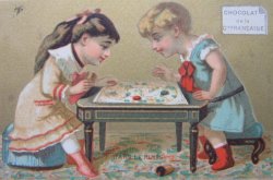
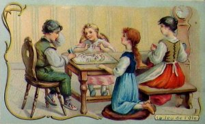
| "The Development of the English Board Game", 1770-1850 (Caroline G. Goodfellow) | ||
| Geographical Games. "Table Games of Georgian and Victorian Days". (Francis Reginald Beaman, Whitehause) | ||
Vai alla ricerca giochi Vai all'elenco autori