Giochi dell'Oca e di percorso
(by Luigi Ciompi & Adrian Seville)
(by Luigi Ciompi & Adrian Seville)

|
Giochi dell'Oca e di percorso
(by Luigi Ciompi & Adrian Seville) |

|
 |
Torna alla ricerca giochi (back to game search) |
 |
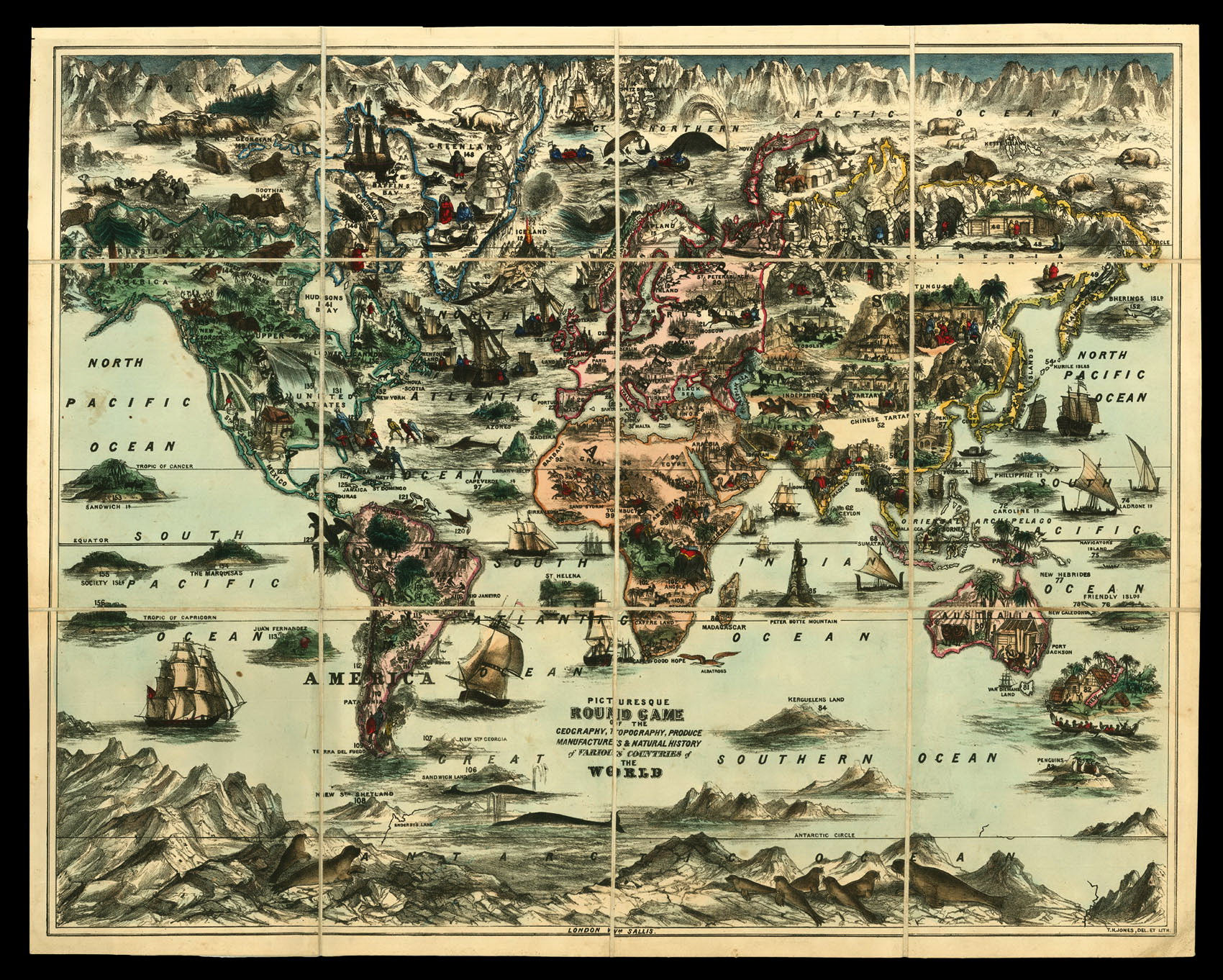
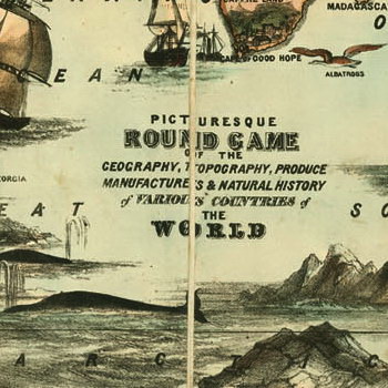
| Picturesque Round Game of the Geography, Topography, Produce, Manufactures and Natural History of various countries of the World | ||
 |
Versione stampabile
 |
Invia una segnalazione

|
     |
primo autore: | T. N. Jones |
| secondo autore: | Sallis William | |
| anno: | 1845 | |
| luogo: |
Inghilterra-Londra |
|
| periodo: | XIX secolo (2°/4) | |
| percorso: | Percorso di 156 caselle numerate | |
| materiale: | carta (paper) (papier) | |
| dimensioni: | 520X635 | |
| stampa: | Litografia montata su lino e colorata (lithograph coloured and mounted in 12 sections on linen) | |
| luogo acquisto: | ||
| data acquisto: | ||
| dimensioni confezione: | ||
| numero caselle: | 156 | |
| categoria: | Geografia | |
| tipo di gioco: | Gioco di percorso | |
| editore: | William Sallis, Cross Key Square | |
| stampatore: | T. N. Jones Del. et Lith. | |
| proprietario: | Collezione Privata | |
| autore delle foto: | Privato | |
| numero di catalogo: | 2530 | |
| descrizione: |
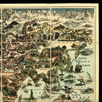
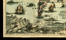
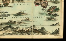
Gioco di 156 caselle numerate distribuite sulla carta geografica del mondo. REGOLE: non riportate sul tavoliere. CASELLE: mute. REFERENZA 1 WHITEHOUSE, Francis Reginald Beaman: PICTURESQUE ROUND GAME of the Geography, Topography, Produce Manufactures and Natural History of various countries of the world. London. Wm. Sallis. (notdated.) A lithograph size 25 in X 20 ½ in, coloured and mounted in 12 sections on linen, folded into boards cloth-covered and stamped in gilt “Picturesque Voyage Round the World". Size 6 ½ in X 8 ¼ in. A map of the world (not drawn to scale) with perspective sketches of leading features. T. H. Jones, Del. et Lith. A number of ships are shown but one only has a funnel-a paddle steamer off the Cape of Good Hope. In North America, the western coast is termed “Russian America". In Upper Canada “Dog Ribbed Indians” are seen pursuing Buffaloes. South America comprises GUIANA, PERU, BRAZIL, PARAGUAY, LA PLATA and PATAGONIA. In Australia the only town marked is Port Jackson. Tasmania is termed “VAN DIEMAN’S LAND". REFERENZA 2 Picturesque Round Game of the Geography, Topography, Produce, Manufactures & Natural History of Various Countries of the World. London: William Sallis, [1845]. Hand-colored lithographic map game, 25 x 20.5 inches, folding into original green cloth covers. Housed in a custom slipcase and chemise. First edition of this hand-colored travel board game, a striking example of popular Victorian cartography. Players begin their journey within the British Isles, following the numbers from Europe to Asia, Australia to Africa, through the Americas, finally landing in the South Seas. Along the way, the travellers encounter vivid and sometimes fanciful scenes of adventure: African tribesmen hunting elephants, Arab horsemen trapped in a sand storm, Esquimaux battling polar bears. Niagara Falls consumes half a continent, slaves pick cotton in California, Iceland is a volcano, and penguins occupy their own nation. A fascinating glimpse at how the British at home saw their place in the world. |
|
| bibliografia: |
1) WHITEHAUSE, F.R.B.: "Table Games of Georgian and Victorian Days", London, Peter Garnett, 1951. 2) GOODFELLOW, Caroline: "A Collector's Guide to Games and Puzzles". Secaucus, New Jersey, Chartwell Books-London, Quintet Publishing Limited 1991. 3) GOODFELLOW, Caroline: "The Development of the English Board Game, 1770-1850", in Board Games Studies 1, 1998. 4) GOODFELLOW, Caroline: "Jeux de société. Le guide du collectionneur des jeux de société depuis le XVIIIe siècle jusqu’à nos jours", (Edizione francese) Carrousel MS, 2001. 5) SEVILLE, Adrian: "The Game of Goose: and its influence on cartographical race games" Journal of the International Map Collectors' Society, Winter 2008 N°115 2008. 6) SEVILLE, Adrian: "The geographical Jeux de l'Oie of Europe." In "Belgeo" 2008 3-4 2008. 7) GOODFELLOW, Caroline: "How We Played: Games From Childhood Past", History Press, 2012. 8) QUINN, Brian - CARTWRIGHT, William: "Geographic Board Games". Geospatial Science Research 3. School of Mathematical and Geospatial Science, RMIT University, Australia. December 2014. 9) SEVILLE, Adrian: "The Royal Game of the Goose four hundred years of printed Board Games". Catalogue of an Exhibition at the Grolier Club, February 23 - May 14, 2016. 10) LIMAN, Ellen: "Georgian and Victorian Board Games: The Liman Collection", Pointed Leaf Press, 2017. 11) NORCIA, Megan A.: "Gaming Empire in Children's British Board Games, 1836-1860". Studies in Childhood, 1700 to the Present. Routledge, 2019. 12) PARLAK, Ömer Fatih: "The Image of the Turk in Early Modern Board Games and Playing Cards". PHD THESIS. Universitat Autonoma de Barcelona, 2019. 13) LudoSophia: "Jeux Anciens de Planisphère et de Mappemonde - Ancient Games with World Map, 2019. |
|
| "The Development of the English Board Game, 1770-1850" (Caroline G. Goodfellow) | ||
| Geographical Games. "Table Games of Georgian and Victorian Days". (Francis Reginald Beaman, Whitehause) | ||
Vai alla ricerca giochi Vai all'elenco autori